Approximate Location Map
Large Map »
Latitude: 51.4455 / 51°26'43"N
Longitude: -1.0131 / 1°0'47"W
OS Eastings: 468680
OS Northings: 172296
OS Grid: SU686722
Mapcode National: GBR Q9K.K8
Mapcode Global: VHDWS.DX8R
Plus Code: 9C3WCXWP+6P
Entry Name: Milepost
Listing Date: 14 December 1978
Grade: II
Source: Historic England
Source ID: 1321988
English Heritage Legacy ID: 38759
ID on this website: 101321988
Location: Southcote, Reading, Berkshire, RG30
County: Reading
Electoral Ward/Division: Southcote
Parish: Non Civil Parish
Built-Up Area: Reading
Traditional County: Berkshire
Lieutenancy Area (Ceremonial County): Berkshire
Church of England Parish: Tilehurst St Michael
Church of England Diocese: Oxford
Tagged with: Milestone
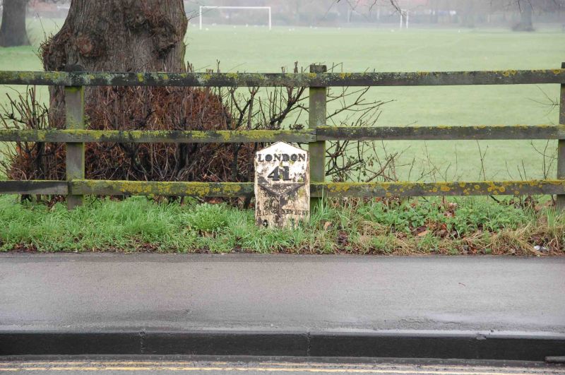
BATH ROAD
1.
5128
(North Side)
Milepost
SU 67 SE 16/407
II
2.
About 130 yds east of Honeyend Lane. Mid C19. By T & J Perry of Reading.
Cast iron. Triangular shape with 'Reading 2 miles' to east, 'Newbury 15 miles'
to west and 'London 41' on panel above.
Listing NGR: SU6868072295
External links are from the relevant listing authority and, where applicable, Wikidata. Wikidata IDs may be related buildings as well as this specific building. If you want to add or update a link, you will need to do so by editing the Wikidata entry.


Other nearby listed buildings
