Approximate Location Map
Large Map »
Latitude: 54.6441 / 54°38'38"N
Longitude: -2.799 / 2°47'56"W
OS Eastings: 348537
OS Northings: 527963
OS Grid: NY485279
Mapcode National: GBR 8GWQ.TZ
Mapcode Global: WH819.ZJBL
Plus Code: 9C6VJ6V2+MC
Entry Name: Hopland House
Listing Date: 24 October 1986
Grade: II
Source: Historic England
Source ID: 1326703
English Heritage Legacy ID: 73806
ID on this website: 101326703
Location: Stainton, Westmorland and Furness, Cumbria, CA11
County: Cumbria
District: Eden
Civil Parish: Dacre
Built-Up Area: Stainton
Traditional County: Cumberland
Lieutenancy Area (Ceremonial County): Cumbria
Church of England Parish: Dacre St Andrew
Church of England Diocese: Carlisle
Tagged with: House
NY 42 NE DACRE STAINTON
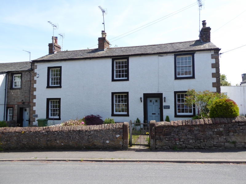
16/85 Hopland House
II
House. Late C18. Painted rendered walls with V-jointed quoins, under graduated
greenslate roof with rebuilt red sandstone chimney stacks. 2 storeys, 3 bays.
Off-centre top-glazed panelled door, and sash windows with glazing bars, all in
painted stone surrounds. Left lower extension, now Hopland Cottage, is not of
interest.
Listing NGR: NY4853727963
External links are from the relevant listing authority and, where applicable, Wikidata. Wikidata IDs may be related buildings as well as this specific building. If you want to add or update a link, you will need to do so by editing the Wikidata entry.


Other nearby listed buildings
