Approximate Location Map
Large Map »
Latitude: 54.5949 / 54°35'41"N
Longitude: -1.0497 / 1°2'58"W
OS Eastings: 461498
OS Northings: 522601
OS Grid: NZ614226
Mapcode National: GBR PH39.JN
Mapcode Global: WHF80.VRBW
Plus Code: 9C6WHXV2+W4
Entry Name: Garden Wall South of Wheatlands Farmhouse
Listing Date: 29 April 1988
Grade: II
Source: Historic England
Source ID: 1329630
English Heritage Legacy ID: 60343
ID on this website: 101329630
Location: Redcar and Cleveland, North Yorkshire, TS10
County: Redcar and Cleveland
Electoral Ward/Division: West Dyke
Parish: Non Civil Parish
Built-Up Area: Redcar
Traditional County: Yorkshire
Lieutenancy Area (Ceremonial County): North Yorkshire
Church of England Parish: Redcar St Peter
Church of England Diocese: York
Tagged with: Wall
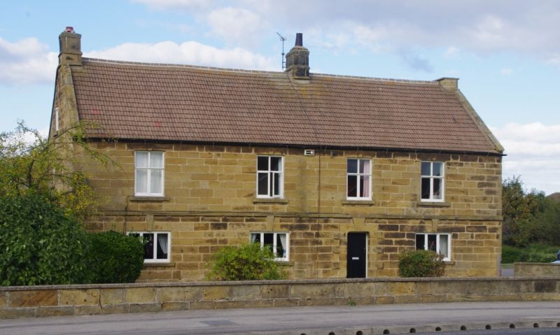
REDCAR REDCAR ROAD, north side
NZ 62 SW
5/86 Garden wall south of
Wheatlands Farmhouse.
G.V. II
Garden wall, mid/late C18, on 3 sides of garden fronting onto Redcar Road.
Chevron-tooled dressed sandstone with renewed flat concrete coping.
Included for group value.
Listing NGR: NZ6149822601
External links are from the relevant listing authority and, where applicable, Wikidata. Wikidata IDs may be related buildings as well as this specific building. If you want to add or update a link, you will need to do so by editing the Wikidata entry.


Other nearby listed buildings
