Approximate Location Map
Large Map »
Latitude: 53.3427 / 53°20'33"N
Longitude: -1.7807 / 1°46'50"W
OS Eastings: 414697
OS Northings: 382884
OS Grid: SK146828
Mapcode National: GBR JY0S.8G
Mapcode Global: WHCCL.M77S
Plus Code: 9C5W86V9+3P
Entry Name: Gate Piers at Goosehill Hall
Listing Date: 21 April 1967
Grade: II
Source: Historic England
Source ID: 1334868
English Heritage Legacy ID: 82487
ID on this website: 101334868
Location: Castleton, High Peak, Derbyshire, S33
County: Derbyshire
District: High Peak
Civil Parish: Castleton
Built-Up Area: Castleton
Traditional County: Derbyshire
Lieutenancy Area (Ceremonial County): Derbyshire
Church of England Parish: Castleton St Edmund
Church of England Diocese: Derby
Tagged with: Gatepost
SK 18 SW PARISH OF CASTLETON BUXTON ROAD
6/26 (South Side)
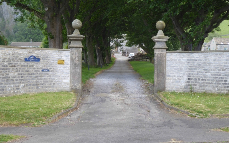
21.4.67 Gate Piers at Goosehill Hall
GV II
Gate piers. C18. Gritstone ashlar. Square plan, rusticated piers with moulded
caps and ball finials. Listed for group value only.
Listing NGR: SK1469782884
External links are from the relevant listing authority and, where applicable, Wikidata. Wikidata IDs may be related buildings as well as this specific building. If you want to add or update a link, you will need to do so by editing the Wikidata entry.


Other nearby listed buildings
