Approximate Location Map
Large Map »
Latitude: 53.0693 / 53°4'9"N
Longitude: -1.7414 / 1°44'28"W
OS Eastings: 417427
OS Northings: 352487
OS Grid: SK174524
Mapcode National: GBR 483.JKH
Mapcode Global: WHCDZ.731T
Plus Code: 9C5W3795+PF
Entry Name: Hands Well
Listing Date: 5 February 1951
Grade: II
Source: Historic England
Source ID: 1335281
English Heritage Legacy ID: 80408
ID on this website: 101335281
Location: Tissington, Derbyshire Dales, Derbyshire, DE6
County: Derbyshire
District: Derbyshire Dales
Civil Parish: Tissington and Lea Hall
Traditional County: Derbyshire
Lieutenancy Area (Ceremonial County): Derbyshire
Church of England Parish: Tissington St Mary
Church of England Diocese: Derby
Tagged with: Well
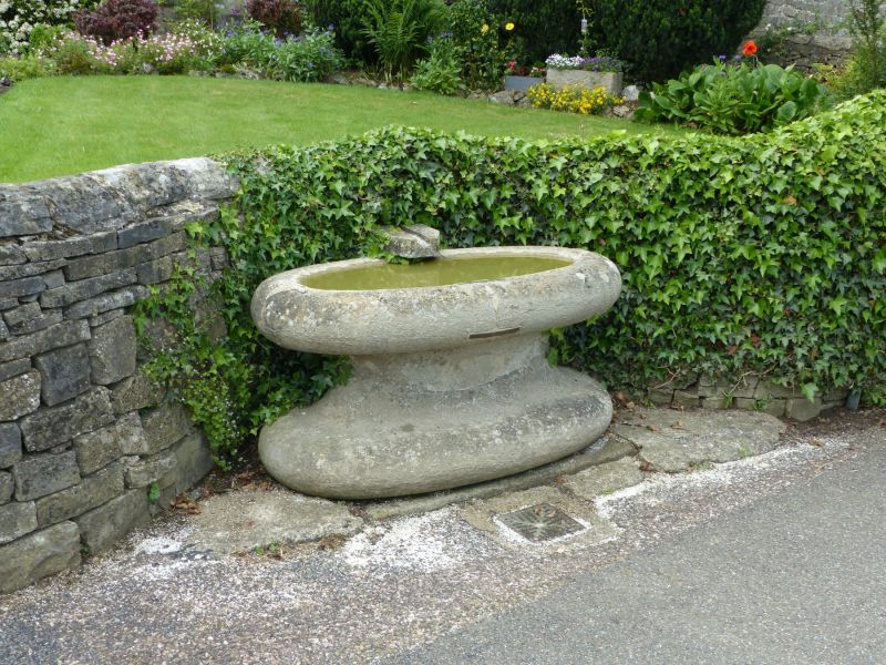
SK 17 52 PARISH OF TISSINGTON RAKES LANE
11/138 (East Side)
5.2.1951 Hands Well
GV II
Well. C18. Gritstone oval basin set in the wall in front of Overfields Farm,
the pedestal tapers in the middle and widens at the base.
Listing NGR: SK1742752487
External links are from the relevant listing authority and, where applicable, Wikidata. Wikidata IDs may be related buildings as well as this specific building. If you want to add or update a link, you will need to do so by editing the Wikidata entry.


Other nearby listed buildings
