Approximate Location Map
Large Map »
Latitude: 54.5499 / 54°32'59"N
Longitude: -3.5966 / 3°35'47"W
OS Eastings: 296823
OS Northings: 518357
OS Grid: NX968183
Mapcode National: GBR 3HBT.4R
Mapcode Global: WH5Z1.QWHV
Plus Code: 9C6RGCX3+X8
Entry Name: Old Fort
Listing Date: 20 July 1949
Grade: II
Source: Historic England
Source ID: 1335968
English Heritage Legacy ID: 75900
ID on this website: 101335968
Location: Whitehaven, Cumberland, Cumbria, CA28
County: Cumbria
District: Copeland
Civil Parish: Whitehaven
Built-Up Area: Whitehaven
Traditional County: Cumberland
Lieutenancy Area (Ceremonial County): Cumbria
Church of England Parish: Kells St Peter
Church of England Diocese: Carlisle
Tagged with: Architectural structure
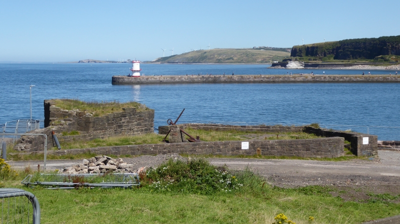
Old Fort
1.
1814
NX 91 NE 2/9 20.7.49.
II
2.
On quayside between Old Quay and Old New Quay. Scanty remains of fortress
built 1639, and attacked by Paul Jones in his celebrated raid on Whitehaven
in April 1778.
Listing NGR: NX9682318357
External links are from the relevant listing authority and, where applicable, Wikidata. Wikidata IDs may be related buildings as well as this specific building. If you want to add or update a link, you will need to do so by editing the Wikidata entry.


Other nearby listed buildings
