Approximate Location Map
Large Map »
Latitude: 51.2727 / 51°16'21"N
Longitude: 0.5209 / 0°31'15"E
OS Eastings: 575941
OS Northings: 155640
OS Grid: TQ759556
Mapcode National: GBR PR7.0K7
Mapcode Global: VHJMD.Z87N
Plus Code: 9F327GFC+39
Entry Name: 69, BANK STREET (See details for further address information)
Listing Date: 2 August 1974
Grade: II
Source: Historic England
Source ID: 1336177
English Heritage Legacy ID: 173354
ID on this website: 101336177
Location: Maidstone, Kent, ME14
County: Kent
District: Maidstone
Electoral Ward/Division: High Street
Parish: Non Civil Parish
Built-Up Area: Maidstone
Traditional County: Kent
Lieutenancy Area (Ceremonial County): Kent
Tagged with: Building
HIGH STREET
1.
5278
BANK STREET
2.
High Street from No 69 to No 88 is known as BANK STREET but the numbering
continues consecutively.
HIGH STREET
1.
5278
BANK STREET
(South-East Side)
No 69
TQ 7555 NE 1/12
II
2.
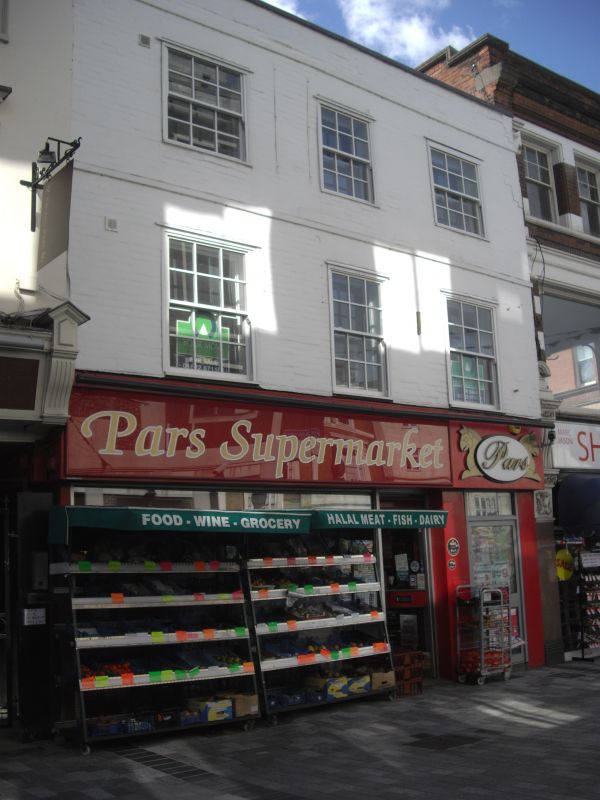
C18. 3 storeys painted brick. Parapet and stringcourse. 3 sashes with glazing
bars intact above the ground floor. Modern shopfront below.
Listing NGR: TQ7594455635
External links are from the relevant listing authority and, where applicable, Wikidata. Wikidata IDs may be related buildings as well as this specific building. If you want to add or update a link, you will need to do so by editing the Wikidata entry.


Other nearby listed buildings
