Approximate Location Map
Large Map »
Latitude: 51.4407 / 51°26'26"N
Longitude: 0.3825 / 0°22'57"E
OS Eastings: 565681
OS Northings: 173993
OS Grid: TQ656739
Mapcode National: GBR NML.MJN
Mapcode Global: VHJLK.L12W
Plus Code: 9F32C9RM+72
Entry Name: Pillar Box at the Junction of Norfolk Road and St John's Road
Listing Date: 3 July 1975
Grade: II
Source: Historic England
Source ID: 1341486
English Heritage Legacy ID: 356396
ID on this website: 101341486
Location: Milton, Gravesham, Kent, DA12
County: Kent
District: Gravesham
Electoral Ward/Division: Riverside
Parish: Non Civil Parish
Built-Up Area: Gravesend
Traditional County: Kent
Lieutenancy Area (Ceremonial County): Kent
Church of England Parish: Milton St Peter and St Paul
Church of England Diocese: Rochester
Tagged with: Pillar box
1.
5277 NORFOLK ROAD
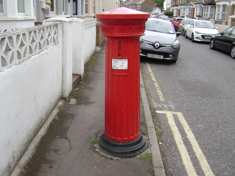
Pillar Box at the
Junction of Norfolk Road
and St John's Road
TQ 67 SE 7/128
II
2.
1856-1860. A fluted pillar box with vertical posting aperture. Conical cap and
moulded base.
Listing NGR: TQ6566173996
External links are from the relevant listing authority and, where applicable, Wikidata. Wikidata IDs may be related buildings as well as this specific building. If you want to add or update a link, you will need to do so by editing the Wikidata entry.


Other nearby listed buildings
