Approximate Location Map
Large Map »
Latitude: 51.1348 / 51°8'5"N
Longitude: 1.299 / 1°17'56"E
OS Eastings: 630894
OS Northings: 142460
OS Grid: TR308424
Mapcode National: GBR W1F.Z2M
Mapcode Global: VHLHB.GQLX
Plus Code: 9F3347MX+WJ
Entry Name: 226, 227 and 228, London Road
Listing Date: 17 December 1973
Grade: II
Source: Historic England
Source ID: 1343827
English Heritage Legacy ID: 177786
ID on this website: 101343827
Location: St Radigund's, Dover, Kent, CT17
County: Kent
District: Dover
Civil Parish: Dover
Built-Up Area: Dover
Traditional County: Kent
Lieutenancy Area (Ceremonial County): Kent
Tagged with: Building
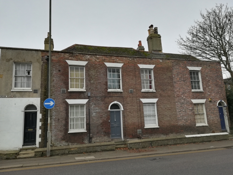
LONDON ROAD
1. (South West Side)
1050
Nos 226, 227 and 228
TR 3042 4/122
II
2.
Early C19. 2 storeys and basement red brick. 2 sashes each with glazing
bars intact. Stone coping. Simple round-headed doorcases with fanlights
and 6 panelled doors.
Listing NGR: TR3089442460
External links are from the relevant listing authority and, where applicable, Wikidata. Wikidata IDs may be related buildings as well as this specific building. If you want to add or update a link, you will need to do so by editing the Wikidata entry.


Other nearby listed buildings
