Approximate Location Map
Large Map »
Latitude: 51.0153 / 51°0'55"N
Longitude: -3.0952 / 3°5'42"W
OS Eastings: 323268
OS Northings: 124562
OS Grid: ST232245
Mapcode National: GBR M1.J9NH
Mapcode Global: FRA 46DF.HZ8
Plus Code: 9C3R2W83+4W
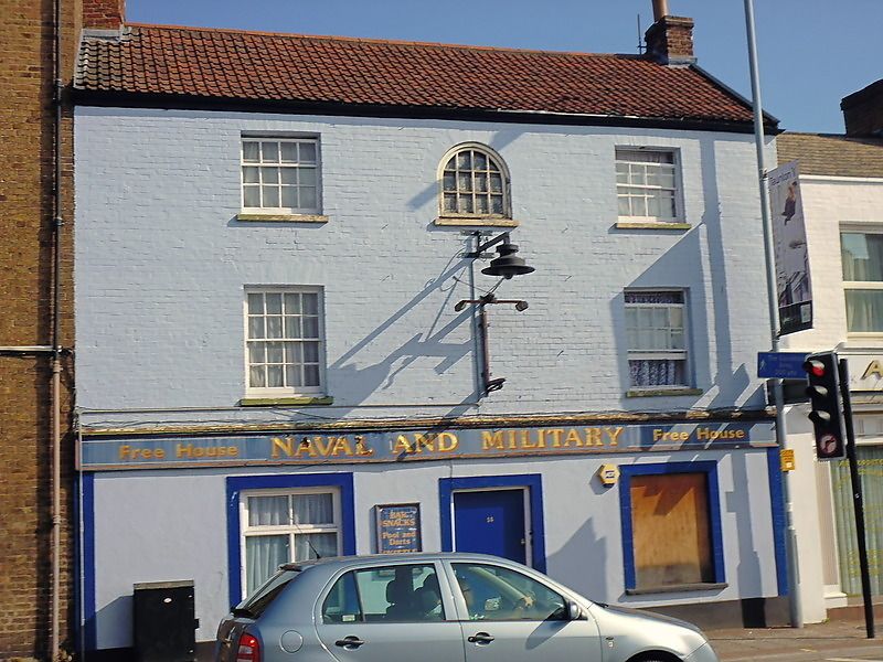
Entry Name: Naval and Military Inn
Listing Date: 4 July 1975
Grade: II
Source: Historic England
Source ID: 1344701
English Heritage Legacy ID: 269681
ID on this website: 101344701
Location: Firepool, Somerset, TA1
County: Somerset
District: Somerset West and Taunton
Electoral Ward/Division: Taunton Eastgate
Parish: Non Civil Parish
Built-Up Area: Taunton
Traditional County: Somerset
Lieutenancy Area (Ceremonial County): Somerset
Tagged with: Inn
EAST REACH
1.
5365
(North Side)
No 14 (Naval and
Military Inn)
ST 2324 NW 12/43
II GV
2.
3 storey early C19 painted brick front, stucco ground floor. Pantile roof.
3 windows (round headed window in centre blocked). Sashes with glazing bars. Recent
ground floor.
Nos 12 to 14 (consec) form a group.
Listing NGR: ST2326824562
External links are from the relevant listing authority and, where applicable, Wikidata. Wikidata IDs may be related buildings as well as this specific building. If you want to add or update a link, you will need to do so by editing the Wikidata entry.


Other nearby listed buildings
