Approximate Location Map
Large Map »
Latitude: 51.4528 / 51°27'9"N
Longitude: -0.2219 / 0°13'18"W
OS Eastings: 523647
OS Northings: 174141
OS Grid: TQ236741
Mapcode National: GBR BK.8Q0
Mapcode Global: VHGR4.3RK5
Plus Code: 9C3XFQ3H+47
Entry Name: Village Pound
Listing Date: 7 April 1983
Grade: II
Source: Historic England
Source ID: 1357673
English Heritage Legacy ID: 207108
ID on this website: 101357673
Location: Putney Heath, Wandsworth, London, SW15
County: London
District: Wandsworth
Electoral Ward/Division: Roehampton
Parish: Non Civil Parish
Built-Up Area: Wandsworth
Traditional County: Surrey
Lieutenancy Area (Ceremonial County): Greater London
Church of England Parish: Putney
Church of England Diocese: Southwark
Tagged with: Pond Animal pound
TQ 27SW
3/18
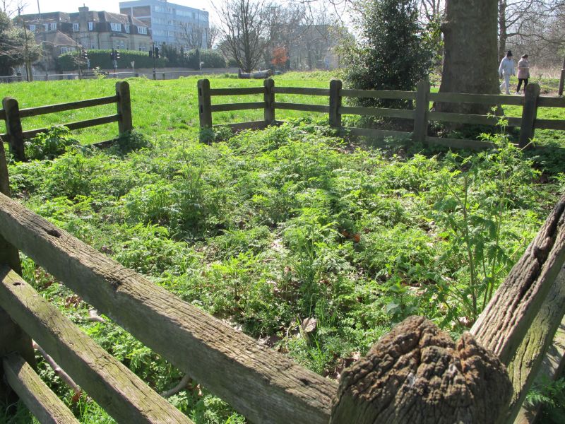
PUTNEY HEATH SW15
Village Pound
II
Probably 19th century but renewed. Wooden. Of roughly rectangular plan. Posts with three tiers of rails.
Listing NGR: TQ2310474156
External links are from the relevant listing authority and, where applicable, Wikidata. Wikidata IDs may be related buildings as well as this specific building. If you want to add or update a link, you will need to do so by editing the Wikidata entry.


Other nearby listed buildings
