Approximate Location Map
Large Map »
Latitude: 51.2467 / 51°14'48"N
Longitude: 0.2852 / 0°17'6"E
OS Eastings: 559588
OS Northings: 152202
OS Grid: TQ595522
Mapcode National: GBR MNG.T2L
Mapcode Global: VHHPT.WXMP
Plus Code: 9F3267WP+M3
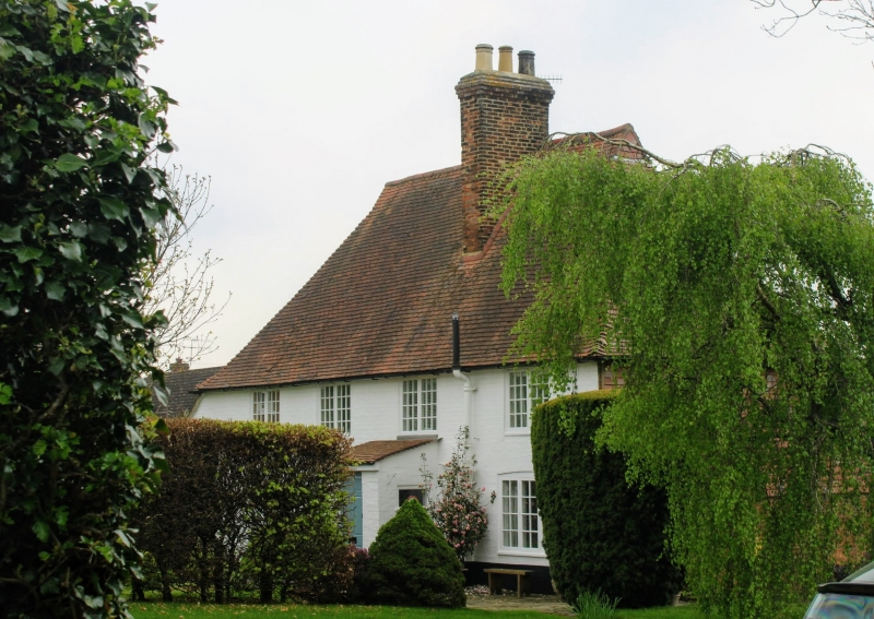
Entry Name: The White House
Listing Date: 3 May 1984
Grade: II
Source: Historic England
Source ID: 1362036
English Heritage Legacy ID: 357391
ID on this website: 101362036
Location: Shipbourne, Tonbridge and Malling, Kent, TN11
County: Kent
District: Tonbridge and Malling
Civil Parish: Shipbourne
Built-Up Area: Shipbourne
Traditional County: Kent
Lieutenancy Area (Ceremonial County): Kent
Church of England Parish: Shipbourne St Giles
Church of England Diocese: Rochester
Tagged with: House
TQ 55 SE SHIPBOURNE THE COMMON
3/27 (south side)
The White House
II
House. C17 framed structure with C18 elevation. Painted brick with steep hipped
plain tiled roof and ridge stack. Two storeys; 4 window front, C19 casements, those
on ground floor with segment-head surrounds. Lean-to addition to left with
half-glazed and panelled door behind modern porch.
Listing NGR: TQ5958652195
External links are from the relevant listing authority and, where applicable, Wikidata. Wikidata IDs may be related buildings as well as this specific building. If you want to add or update a link, you will need to do so by editing the Wikidata entry.


Other nearby listed buildings
