Approximate Location Map
Large Map »
Latitude: 51.1949 / 51°11'41"N
Longitude: 0.7296 / 0°43'46"E
OS Eastings: 590818
OS Northings: 147510
OS Grid: TQ908475
Mapcode National: GBR QTS.57S
Mapcode Global: VHKKC.L7L9
Plus Code: 9F325PVH+XR
Entry Name: Forge Cottages
Listing Date: 10 October 1980
Grade: II
Source: Historic England
Source ID: 1362626
English Heritage Legacy ID: 180872
ID on this website: 101362626
Location: Egerton, Ashford, Kent, TN27
County: Kent
District: Ashford
Civil Parish: Egerton
Traditional County: Kent
Lieutenancy Area (Ceremonial County): Kent
Tagged with: Cottage
1.
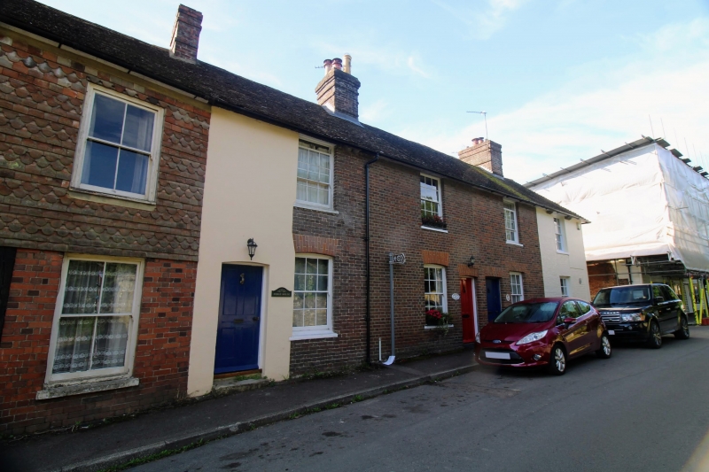
5272 EGERTON THE STREET
(south-east side)
Forge Cottages
(Nos 1 to 4 (consec))
TQ 94 NW 10/162
II GV
2.
Early C19. Two storeys red brick. Tiled roof. Four sashes with glazing bars
intact. Simple doorcase. Included for group value.
Listing NGR: TQ9071047466
External links are from the relevant listing authority and, where applicable, Wikidata. Wikidata IDs may be related buildings as well as this specific building. If you want to add or update a link, you will need to do so by editing the Wikidata entry.


Other nearby listed buildings
