Approximate Location Map
Large Map »
Latitude: 52.4143 / 52°24'51"N
Longitude: -0.6433 / 0°38'36"W
OS Eastings: 492370
OS Northings: 280449
OS Grid: SP923804
Mapcode National: GBR DX4.L5P
Mapcode Global: VHFNS.SLR3
Plus Code: 9C4XC974+PM
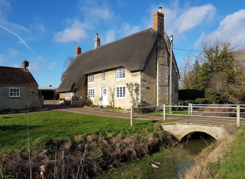
Entry Name: Bridge Circa 10 Metres South East of the Duke's Arms Farmhouse
Listing Date: 19 June 1992
Grade: II
Source: Historic England
Source ID: 1372387
English Heritage Legacy ID: 231103
ID on this website: 101372387
Location: Grafton Underwood, North Northamptonshire, NN14
County: North Northamptonshire
Civil Parish: Grafton Underwood
Traditional County: Northamptonshire
Lieutenancy Area (Ceremonial County): Northamptonshire
Church of England Parish: Grafton Underwood St James the Apostle
Church of England Diocese: Peterborough
Tagged with: Bridge
GRAFTON UNDERWOOD
SP9280 GRAFTON UNDERWOOD
1337-0/16/327 Bridge c.10m SE of The Duke's Arms
Farmhouse
GV II
Bridge. C18/C19. Limestone rubble. Small semi-circular arch
with keystone to north and south. Rudimentary C20 railings.
Listing NGR: SP9237080449
External links are from the relevant listing authority and, where applicable, Wikidata. Wikidata IDs may be related buildings as well as this specific building. If you want to add or update a link, you will need to do so by editing the Wikidata entry.


Other nearby listed buildings
