Approximate Location Map
Large Map »
Latitude: 51.2112 / 51°12'40"N
Longitude: -2.6423 / 2°38'32"W
OS Eastings: 355230
OS Northings: 145970
OS Grid: ST552459
Mapcode National: GBR MN.3Y4Y
Mapcode Global: VH89S.4TZD
Plus Code: 9C3V6965+F3
Entry Name: Water Hydrant Approximately 25 Metres North East of Number 2
Listing Date: 31 May 2000
Grade: II
Source: Historic England
Source ID: 1383105
English Heritage Legacy ID: 483523
ID on this website: 101383105
Location: St Andrew, Somerset, BA5
County: Somerset
District: Mendip
Civil Parish: Wells
Built-Up Area: Wells
Traditional County: Somerset
Lieutenancy Area (Ceremonial County): Somerset
Tagged with: Architectural structure
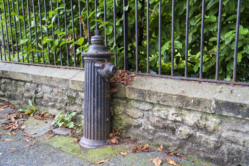
WELLS
ST5445 ST ANDREW STREET
662-1/7/249 (South side)
Water hydrant approx. 25 metres
north east of No.2
GV II
Water hydrant. C19. Cast-iron, made by J Stone and Co.,
Deptford, London. Base buried, fluted circular column on
moulded base, with moulded top and hose connections on top and
on west side.
Listing NGR: ST5523045970
External links are from the relevant listing authority and, where applicable, Wikidata. Wikidata IDs may be related buildings as well as this specific building. If you want to add or update a link, you will need to do so by editing the Wikidata entry.


Other nearby listed buildings
