Approximate Location Map
Large Map »
Latitude: 54.3035 / 54°18'12"N
Longitude: -2.5254 / 2°31'31"W
OS Eastings: 365907
OS Northings: 489898
OS Grid: SD659898
Mapcode National: GBR BLTP.12
Mapcode Global: WH94B.53P5
Plus Code: 9C6V8F3F+CR
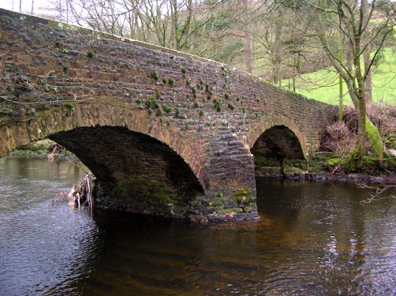
Entry Name: Rash Bridge
Listing Date: 16 March 1954
Grade: II
Source: Historic England
Source ID: 1383928
English Heritage Legacy ID: 484360
ID on this website: 101383928
Location: Westmorland and Furness, Cumbria, LA10
County: Cumbria
District: South Lakeland
Civil Parish: Dent
Traditional County: Yorkshire
Lieutenancy Area (Ceremonial County): Cumbria
Church of England Parish: Dent with Cowgill
Church of England Diocese: Carlisle
Tagged with: Bridge
DENT
SD68NE DENTDALE
162-1/10/130 (South side)
16/03/54 Rash Bridge
GV II
Public road bridge. Probably C18. Coursed rubble. Central pier
with triangular cutwaters on both sides, 2 low segmental
arches with rubble voussoirs, parapets with flat coping.
Listing NGR: SD6590789898
External links are from the relevant listing authority and, where applicable, Wikidata. Wikidata IDs may be related buildings as well as this specific building. If you want to add or update a link, you will need to do so by editing the Wikidata entry.


Other nearby listed buildings
