Approximate Location Map
Large Map »
Latitude: 52.0722 / 52°4'19"N
Longitude: -0.8117 / 0°48'42"W
OS Eastings: 481544
OS Northings: 242200
OS Grid: SP815422
Mapcode National: GBR CZT.5KV
Mapcode Global: VHDSZ.W58T
Plus Code: 9C4X35CQ+V8
Entry Name: Wolverton Viaduct
Listing Date: 18 July 2001
Grade: II
Source: Historic England
Source ID: 1389687
English Heritage Legacy ID: 488395
ID on this website: 101389687
Location: Old Wolverton, Milton Keynes, Buckinghamshire, MK19
County: Milton Keynes
Civil Parish: Haversham-cum-Little Linford
Built-Up Area: Milton Keynes
Traditional County: Buckinghamshire
Lieutenancy Area (Ceremonial County): Buckinghamshire
Church of England Parish: Haversham with Little Linford
Church of England Diocese: Oxford
Tagged with: Viaduct Railway viaduct
891/0/10007
18-JUL-01
HAVERSHAM CUM LITTLE LINFORD
Wolverton Viaduct
II
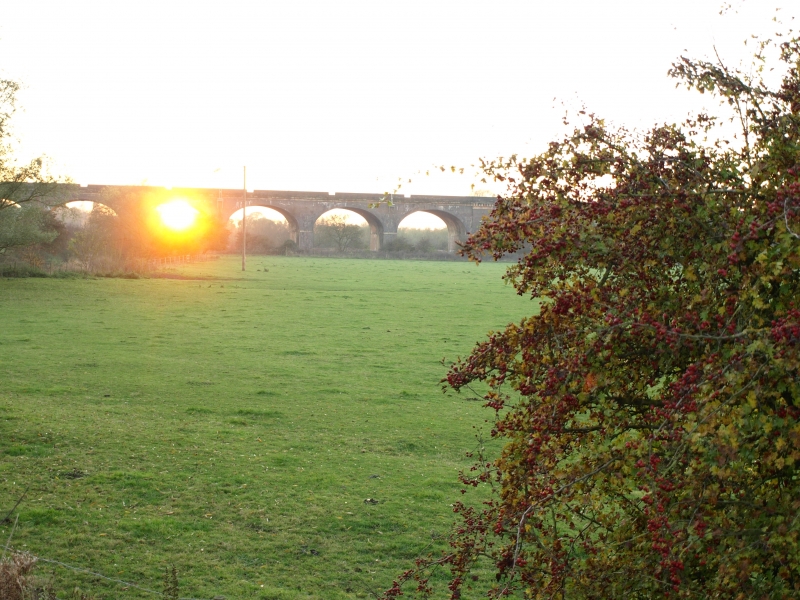
Railway viaduct. Built 1837-8 for the London and Birmingham Railway, engineer Robert Stephenson, widened on the east side 1878-82 by the London and North Western Railway to accommodate two additional lines. Built in red brick in English bond, repaired in blue engineering bricks with red sandstone dressings. Blue engineering brick used throughout in the widened part. The viaduct is 201m long and 17.4m high and has six elliptical main arches, 18.3m wide on high rectangular piers with D-shaped cutwaters at their bases with semi-domed caps. The structure is finished with a prominent stone cornice and a stone-coped parapet; this was broken for refuges and had steel catenaries added at electrification in 1958. The six main arches are framed by giant pilaster buttresses with extra stonework of a frieze band and over sized dentils to cornice. The abutments are pierced by three smaller round-heeded arches above impost bands and a further semi-buried, round-headed arch at either end.
History: The viaduct was built by the London and Birmingham Railway, now the West Coast mainline, over the valley of the river Great Ouse. The line became a part of the London and North Western Railway in 1846, and of the London, Midland and Scottish Railway in 1923. It is the most impressive of the several viaducts on the line, being taller, more elaborately treated and with wider arches. It was one of the principal landmarks of the first trunk railway and one of the earliest viaducts on this scale. The line was quadrupled in 1879-82 and the viaduct was widened by 9.5m to accommodate the extra tracks, the joint can be clearly seen as the structures are not bonded together. Despite this widening the viaduct remains little altered in appearance, apart from the addition of the electric catenaries in 1958.
References: Information from Milton Keynes Borough Council.
J C Bourne, Drawings of the London and Birmingham Railway, London, 1839, pl 24.
External links are from the relevant listing authority and, where applicable, Wikidata. Wikidata IDs may be related buildings as well as this specific building. If you want to add or update a link, you will need to do so by editing the Wikidata entry.


Other nearby listed buildings
