Approximate Location Map
Large Map »
Latitude: 55.9131 / 55°54'47"N
Longitude: -4.8447 / 4°50'40"W
OS Eastings: 222307
OS Northings: 672549
OS Grid: NS223725
Mapcode National: GBR 31.0HPB
Mapcode Global: WH2MG.KM7S
Plus Code: 9C7QW574+74
Entry Name: Roman Bridge
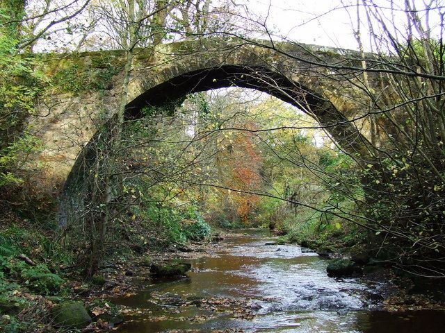
Listing Name: "Roman Bridge" (Sic.) over Kip Water at Millhouse, Dunrod Glen, by Inverkip.
Listing Date: 10 June 1971
Category: B
Source: Historic Scotland
Source ID: 345268
Historic Scotland Designation Reference: LB12468
Building Class: Cultural
ID on this website: 200345268
Location: Inverkip
County: Inverclyde
Electoral Ward: Inverclyde South West
Parish: Inverkip
Traditional County: Renfrewshire
Tagged with: Road bridge
Single-span, 'Pack-horse' Bridge; stone-built; narrow, 6'
wide between low stone parapets; (probably c.1650-1700?)
Not in use.
External links are from the relevant listing authority and, where applicable, Wikidata. Wikidata IDs may be related buildings as well as this specific building. If you want to add or update a link, you will need to do so by editing the Wikidata entry.


Other nearby listed buildings
