Approximate Location Map
Large Map »
Latitude: 54.9391 / 54°56'20"N
Longitude: -3.93 / 3°55'47"W
OS Eastings: 276458
OS Northings: 562197
OS Grid: NX764621
Mapcode National: GBR 0CZB.Z8
Mapcode Global: WH4W0.L3TY
Plus Code: 9C6RW3QC+J2
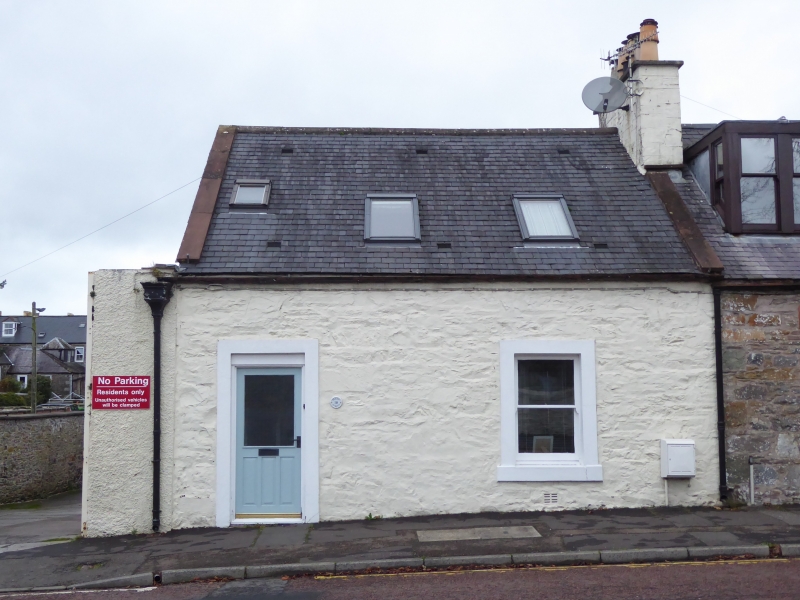
Entry Name: 118 Queen Street, Castle Douglas
Listing Name: 114-118 (Even Nos) Queen Street
Listing Date: 16 February 1981
Category: C
Source: Historic Scotland
Source ID: 358714
Historic Scotland Designation Reference: LB22977
Building Class: Cultural
ID on this website: 200358714
Location: Castle Douglas
County: Dumfries and Galloway
Town: Castle Douglas
Electoral Ward: Castle Douglas and Crocketford
Traditional County: Kirkcudbrightshire
Tagged with: Architectural structure
Early 19th century. Terrace of 3 single-storey and attic
2-bay cottages. No 114 modern harl, Nos 116-118 painted
rubble with raised margins. Sash and case windows, 12-pane
glazing. Nos 114 and 116 have later dormers. Slate roofs, end
and axial stacks.
Single storey painted rubble wings to rear.
External links are from the relevant listing authority and, where applicable, Wikidata. Wikidata IDs may be related buildings as well as this specific building. If you want to add or update a link, you will need to do so by editing the Wikidata entry.


Other nearby listed buildings
