Approximate Location Map
Large Map »
Latitude: 51.8299 / 51°49'47"N
Longitude: -2.7148 / 2°42'53"W
OS Eastings: 350839
OS Northings: 214829
OS Grid: SO508148
Mapcode National: GBR FL.VTFM
Mapcode Global: VH86T.W8NJ
Plus Code: 9C3VR7HP+X3
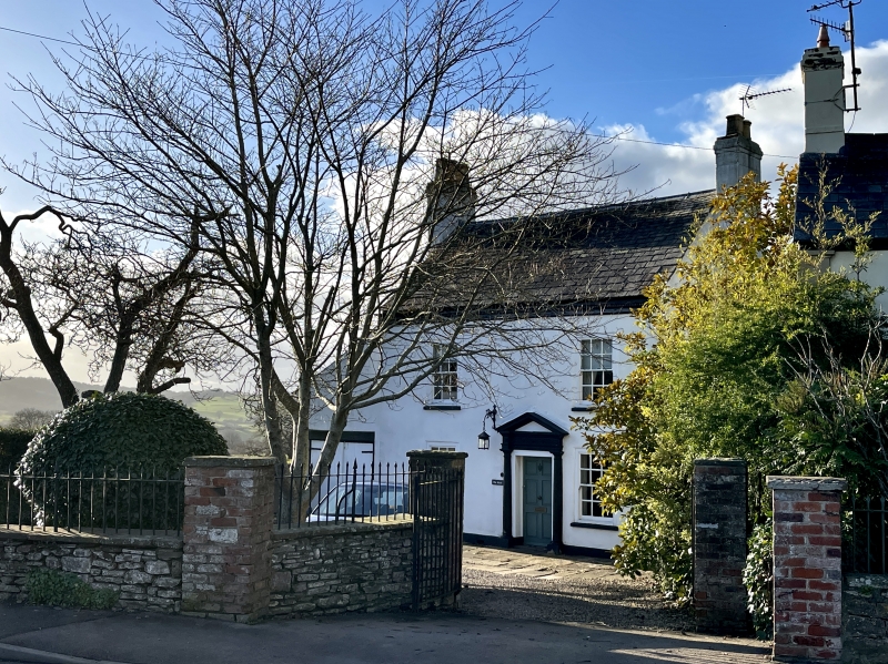
Entry Name: The Maze
Listing Date: 15 August 1974
Last Amended: 10 August 2005
Grade: II
Source: Cadw
Source ID: 2369
Building Class: Domestic
ID on this website: 300002369
Location: On the main road going north out of Monmouth which rises slowly above the town.
County: Monmouthshire
Town: Monmouth
Community: Monmouth (Trefynwy)
Community: Monmouth
Locality: Buckholt
Traditional County: Monmouthshire
Tagged with: Architectural structure
A mostly early C18 house, but the irregular elevation suggests that it is a remodelling of an older building and it has also been changed in the C19 and C20.
Wholly rendered and painted exterior, formerly with quoins, and having a Welsh slate roof. Two storeys and attic, double depth plan with lean-to extensions on both gables. Two windows, 6 over 6 pane sashes in flush frames. Off-centre pedimented porch with Doric columns 1/2 columns, and 6-panel door (the three balls in the pediment mentioned in the previous list description have gone). Steeply pitched gabled roof with external stack on either gable and 2-light garret window. Lean-to extension on right side with secondary door and matching garage on left. Rear elevation not seen.
Not available at resurvey but the elevation suggests a direct entry plan.
Included for its special architectural interest as a small Georgian house on the outskirts of Monmouth.
External links are from the relevant listing authority and, where applicable, Wikidata. Wikidata IDs may be related buildings as well as this specific building. If you want to add or update a link, you will need to do so by editing the Wikidata entry.


Other nearby listed buildings
