Approximate Location Map
Large Map »
Latitude: 53.3254 / 53°19'31"N
Longitude: -4.6363 / 4°38'10"W
OS Eastings: 224519
OS Northings: 384185
OS Grid: SH245841
Mapcode National: GBR GMXX.C1Y
Mapcode Global: WH314.RPF0
Plus Code: 9C5Q89G7+5F
Entry Name: Holyhead Breakwater
Listing Date: 19 July 1988
Last Amended: 25 July 1994
Grade: II*
Source: Cadw
Source ID: 5743
Building Class: Maritime
Also known as: Holyhead Breakwater, Soldier's Point
ID on this website: 300005743
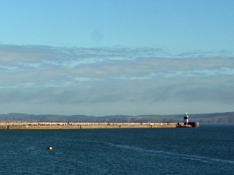
Location: Enormous Z-plan breakwater (2.4km long) stretches into Holyhead bay from Soldier’s Point, NW of town centre.
County: Isle of Anglesey
Community: Holyhead (Caergybi)
Community: Holyhead
Locality: Soldier's Point
Built-Up Area: Holyhead
Traditional County: Anglesey
Tagged with: Breakwater
Work began 1848, declared complete August 1873 by Prince of Wales (later Edward VIII); cost £1,285,000. Plans prepared 1845 for the Treasury by James Meadows Rendell, engineer, of Westminster (previously employed on docks at Birkenhead, Great Grimsby and Leith). Works completed by John Hawkshaw, superintending engineer from 1857-73, John Dobson, resident engineer, G F Lyster, assistant engineer; contractors Messrs J & C Rigby, of London. Local quartz rubble from Holyhead mountain (over 7,000,000 tonnes) brought down by purpose-built broad gauge railway; upper parts built in Moelfre limestone. Originally a second breakwater to S was planned (beginning at Salt Island), but instead a major extension towards NE increased harbour area enclosed.
Breakwater starts with an extended and consolidated rocky headland of rubble fill with massive squared blocks to outer revetments. Masonry landing stage to harbour side. Narrower pier runs NW from junction at ashlar drum with rope-mould cornice; massive attached parapet. Broad elliptical string course to seaward side with rubble blocks below; raised walkway and protective wall with oversailing cornice. Cyclopean dressings to inset stairways (with stone barriers) flanked by concave refuges to lower deck; alternating masonry blockhouses with central arched openings. Occasional waisted bollards and inset stairways to harbour edge of lower deck (formerly with tramway lines). Towards outer end is a modern masonry exedra facing harbour. Cyclopean steps flanked by screen wall with rope-moulded turret lead up to outermost platform with lighthouse and parapets. Outer ovoid platform was formerly a gun platform.
Graded II* as the longest and one of the most monumental piers in the British Isles.
External links are from the relevant listing authority and, where applicable, Wikidata. Wikidata IDs may be related buildings as well as this specific building. If you want to add or update a link, you will need to do so by editing the Wikidata entry.


Other nearby listed buildings
