Approximate Location Map
Large Map »
Latitude: 51.7693 / 51°46'9"N
Longitude: -4.4642 / 4°27'51"W
OS Eastings: 230064
OS Northings: 210724
OS Grid: SN300107
Mapcode National: GBR D7.ZRBP
Mapcode Global: VH3LS.KSSH
Plus Code: 9C3QQG9P+P8
Entry Name: Cross, The Grist
Listing Date: 25 September 1986
Last Amended: 25 September 1986
Grade: II
Source: Cadw
Source ID: 9630
Building Class: Religious, Ritual and Funerary
ID on this website: 300009630
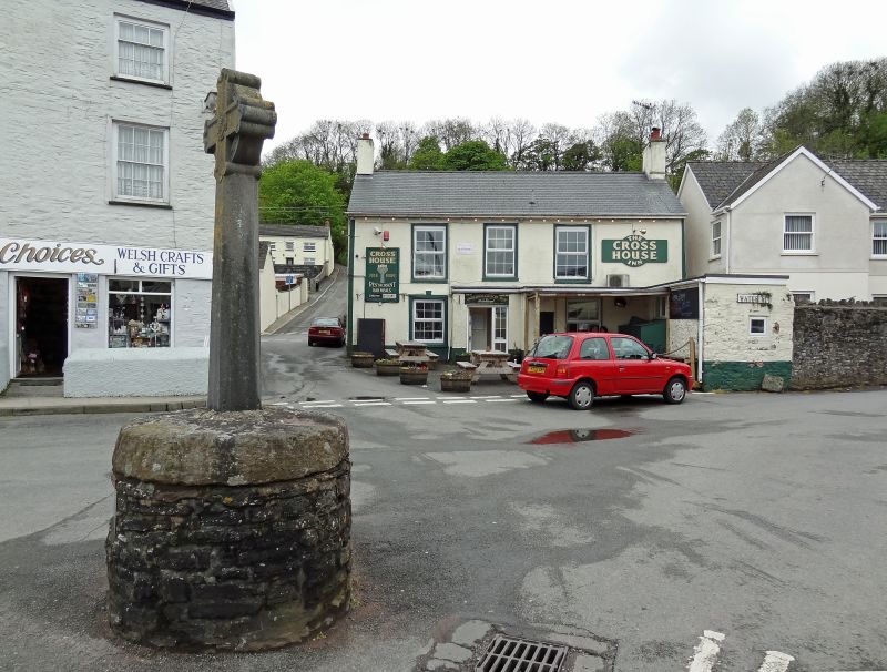
Location: At the western end of a broad tarmac area close to the foreshore.
County: Carmarthenshire
Community: Laugharne Township (Treflan Lacharn)
Community: Laugharne Township
Built-Up Area: Laugharne
Traditional County: Carmarthenshire
Tagged with: Stone cross
The name of the area refers to a grist-mill that existed here.
John Wesley is said to have preached from the cross.
Stone Celtic Crucifix on rubble drum base; rope ornamentaiton. Base plaque inscribed "This New Cross was palced on the Old base 1911, G Williams, Sculptor, Laugharne" and stamped with the badge of Laugharne Corporation.
Group value.
External links are from the relevant listing authority and, where applicable, Wikidata. Wikidata IDs may be related buildings as well as this specific building. If you want to add or update a link, you will need to do so by editing the Wikidata entry.


Other nearby listed buildings
