Approximate Location Map
Large Map »
Latitude: 51.5272 / 51°31'37"N
Longitude: -3.255 / 3°15'18"W
OS Eastings: 313033
OS Northings: 181664
OS Grid: ST130816
Mapcode National: GBR HT.H5YP
Mapcode Global: VH6DZ.JWK4
Plus Code: 9C3RGPGV+VX
Entry Name: Gelynis Farm-range
Listing Date: 24 February 2000
Last Amended: 20 July 2000
Grade: II
Source: Cadw
Source ID: 22855
Building Class: Agriculture and Subsistence
ID on this website: 300022855
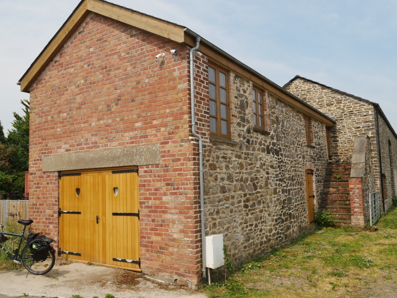
Location: At right angles to farmhouse and cottage on W side of farmyard.
County: Cardiff
Community: Radyr and Morganstown (Radur a Phentre-poeth)
Community: Radyr and Morganstown
Locality: Morganstown
Built-Up Area: Cardiff
Traditional County: Glamorgan
Tagged with: Architectural structure
The range nearest farm with loft is probably the earliest though much altered; centre barn added probably early C19, with byre added later C19. Roofs to barn and byre replaced after fire in 1984.
Long range comprising in centre barn and attached former byre right and store left. Of stone rubble with some brick dressings and Welsh slate roof to end unit left, replaced concrete tile roof to barn and byre. Barn has tall cambered-arched doorway with voussoirs, ventilation slits, at end left a low arched cart bay and 2 smaller cambered arched doors end right with rectangular ventilators above. Attached former byre to right has cambered arched openings with brick dressings, loft above. Attached unit left has been altered with inserted doors and windows with brick dressings, stairs to loft parallel with frontage. Cobbled drive to front.
Barn interior has replaced timbers to roof; wooden lintels to openings, enclosed ground floor rooms at each end. Former byre also has replaced roof, remains of concrete stalls and mangers, remains of floor to hay-loft.
Included as a farm range illustrating the development of this important site, for group value with this important grade II* farmhouse.
External links are from the relevant listing authority and, where applicable, Wikidata. Wikidata IDs may be related buildings as well as this specific building. If you want to add or update a link, you will need to do so by editing the Wikidata entry.


Other nearby listed buildings
