Approximate Location Map
Large Map »
Latitude: 51.6109 / 51°36'39"N
Longitude: -3.3364 / 3°20'10"W
OS Eastings: 307560
OS Northings: 191070
OS Grid: ST075910
Mapcode National: GBR HQ.9PJ6
Mapcode Global: VH6DK.4R1Z
Plus Code: 9C3RJM67+8F
Entry Name: Railway Bridge over Graig-yr-Hesg Road, including integral stone drainage channel
Listing Date: 26 February 2001
Last Amended: 26 February 2001
Grade: II
Source: Cadw
Source ID: 24889
Building Class: Transport
ID on this website: 300024889
Location: Reached uphill from Berw Road approx 0.6 km N of Pontypridd Old Bridge.
County: Rhondda Cynon Taff
Town: Pontypridd
Community: Pontypridd
Community: Pontypridd
Locality: Coed-pen-maen
Traditional County: Glamorgan
Tagged with: Railway bridge
The Taff Vale Railway was the first major locomotive railway in Wales. It was incorporated in 1836, built 1837-40 and opened in 1840-1 from Merthyr Tydfil to Cardiff, primarily to serve the ironworks of Merthyr Tydfil. The chief engineer was Isambard Kingdom Brunel. The railway was built to the standard gauge, rather than Brunel's preferred broad gauge, because it was primarily intended as a mineral railway, although extant original bridges are wide enough to have accommodated a broad-gauge track. The railway was widened to a double track in the period 1845-61. As branch lines were built to the Cynon and Rhondda valleys later in the C19 mineral traffic, largely coal, increased dramatically making Pontypridd an important focal point of the S Wales railway network.
The bridge is an original component of the Taff Vale Railway. It was widened c1861, and again in three successive phases in the late C19. The drainage channel was built in 1837-41 and is also an original component of the railway. It is an unusual feature to be associated with a bridge, but was built to control the flow of a stream on the steep hill to the W side.
A single-span railway bridge in 5 phases. On the outer downhill (E) side is an keyed elliptical arch in rock-faced stone, with impost band and a band below the parapet, which has plain copings. Splayed abutment walls retaining the embankment have rock-faced copings and terminate in square piers. On the outer uphill side is a plate girder span, probably the latest of the phases, with an added projecting concrete footway. The battered abutments have short rectangular piers at the ends of the parapet. The abutment on the S side clearly belongs to the original phase of the bridge and is of rock-faced stone, but has been heightened in rubble stone. The abutment on the N side is of rubble stone and abuts the original phase of the bridge.
The plate-girder span is supported by a crude tapering stone pier with V-shaped ends. The earliest phase of the bridge is immediately downhill of this. It has rock-faced abutments, impost bands and hammer-dressed stone soffit in typical Brunel style. The second phase, added c1861, abuts it on the downhill side and has similar detail but is narrower. Next downhill is a narrow plate girder span, followed by the easternmost outer span, which was built to accommodate a double track and has a white-brick soffit.
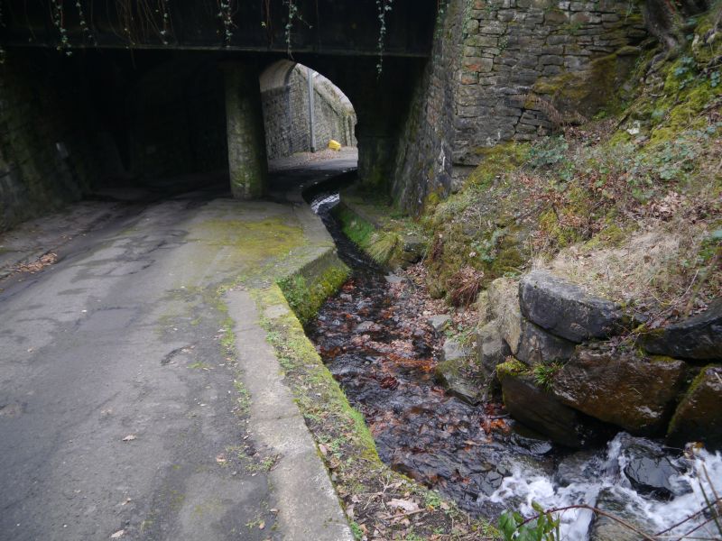
The drainage channel is built close to the S abutments, and comprises a watercourse with a U-shaped profile, of coursed hammer-dressed stone. The water flows into a culvert on the E side of the bridge.
Listed as an original component of the Taff Vale Railway, the successive additions to which document the growth of railway traffic in the late C19, and for its unusual integral drainage channel.
External links are from the relevant listing authority and, where applicable, Wikidata. Wikidata IDs may be related buildings as well as this specific building. If you want to add or update a link, you will need to do so by editing the Wikidata entry.


Other nearby listed buildings
