Approximate Location Map
Large Map »
Latitude: 51.5 / 51°29'59"N
Longitude: -3.1697 / 3°10'10"W
OS Eastings: 318905
OS Northings: 178542
OS Grid: ST189785
Mapcode National: GBR KLD.78
Mapcode Global: VH6F7.0KPG
Plus Code: 9C3RFRXJ+X4
Entry Name: Bridge over Roath brook in Roath Park Recreation Ground
Listing Date: 24 May 2002
Last Amended: 24 May 2002
Grade: II
Source: Cadw
Source ID: 26662
Building Class: Gardens, Parks and Urban Spaces
ID on this website: 300026662
Location: To the E of Alder Road and on the W side of the Recreation Ground.
County: Cardiff
Town: Cardiff
Community: Plasnewydd
Community: Plasnewydd
Locality: Roath Park
Built-Up Area: Cardiff
Traditional County: Glamorgan
Tagged with: Bridge
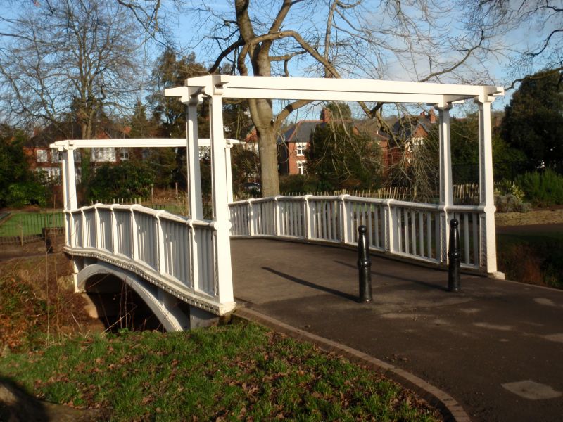
Roath Park was the first publicly owned park in Cardiff and was designed to provide a wide range of recreational facilities for the inhabitants of east Cardiff. The land was donated by the 3rd Marquess of Bute, Lord Tredegar and other land owners. The park was laid out by William Harpur, the borough engineer, between 1887 and 1894. The S end of the park, between Ninian Road and Ty Draw Road, was conceived as Pleasure Gardens and recreation ground further E. The footbridge over Roath brook was built in 1894.
A single-span bridge with brick abutments and flat concrete deck supported by concrete spine and cross beams. The parapet is a cast iron balustrade with intermediate fluted posts and nailhead ornamentation to the caps. The parapets terminate in concrete piers with pyramidal caps, attached to which the bridge approaches have simple iron railings. The deck is laid with tarmac.
Listed as a late C19 bridge of distinctive character, and for group value with other contemporary Roath Park bridges in Plasnewydd and Cyncoed communities.
External links are from the relevant listing authority and, where applicable, Wikidata. Wikidata IDs may be related buildings as well as this specific building. If you want to add or update a link, you will need to do so by editing the Wikidata entry.


Other nearby listed buildings
