Approximate Location Map
Large Map »
Latitude: 51.8718 / 51°52'18"N
Longitude: -4.1517 / 4°9'6"W
OS Eastings: 251963
OS Northings: 221436
OS Grid: SN519214
Mapcode National: GBR DN.SBTL
Mapcode Global: VH4J1.060X
Plus Code: 9C3QVRCX+P8
Entry Name: Ty Llandre
Listing Date: 1 April 2003
Last Amended: 1 April 2003
Grade: II
Source: Cadw
Source ID: 81020
Building Class: Domestic
ID on this website: 300081020
Location: Approximately 80m NNE of the parish church on the N side of the road through the village.
County: Carmarthenshire
Community: Llanegwad
Community: Llanegwad
Traditional County: Carmarthenshire
Tagged with: Building
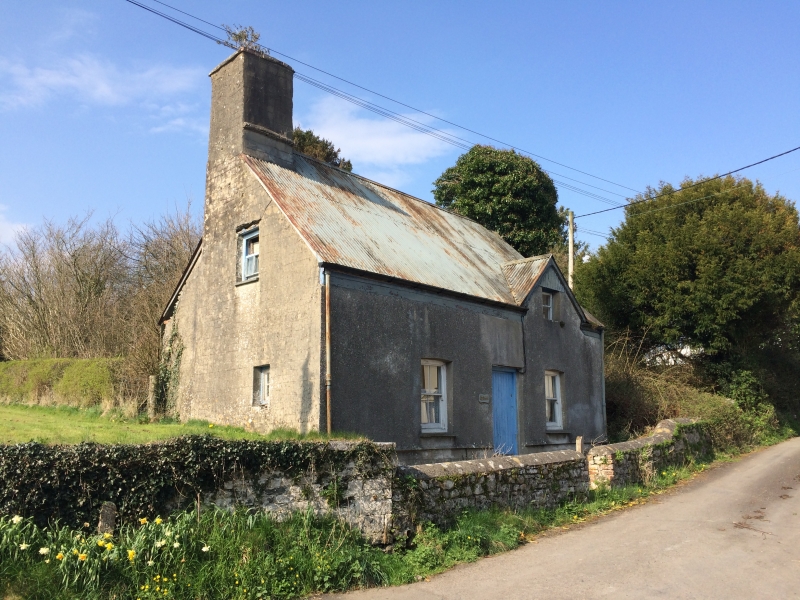
Probably late C17 and shown on the 1839 Tithe map sub-divided, with a former attached agricultural range, into 4 separate dwellings.
A 1½-storey house of rubble stone with roughcast front, steep corrugated iron roof, gable stack to the R and end stack to the L, both roughcast. Both stacks have a dripstone that suggests a former thatch roof. The openings are late C19 and comprise a central boarded door flanked by unequally placed 4-pane horned sash windows. A gable above the R-hand window has a small replaced attic window. In the R gable end is a blocked wood-lintelled doorway L of the stack that led into an attached range since demolished. In the L gable end, which is stepped back on the L side of the stack, is a small window lower R and above it a 4-pane attic sash window.
Not inspected.
Listed as a C17 house retaining its vernacular character, and for group value with other associated listed items contributing to the historic integrity of the village.
External links are from the relevant listing authority and, where applicable, Wikidata. Wikidata IDs may be related buildings as well as this specific building. If you want to add or update a link, you will need to do so by editing the Wikidata entry.


Other nearby listed buildings
