Approximate Location Map
Large Map »
Latitude: 51.0069 / 51°0'24"N
Longitude: -2.1962 / 2°11'46"W
OS Eastings: 386332
OS Northings: 123070
OS Grid: ST863230
Mapcode National: GBR 1XH.X59
Mapcode Global: FRA 669G.07K
Plus Code: 9C3V2R43+PG
Entry Name: 29, Bell Street
Listing Date: 15 October 1973
Grade: II
Source: Historic England
Source ID: 1108790
English Heritage Legacy ID: 101957
ID on this website: 101108790
Location: Shaftesbury, Dorset, SP7
County: Dorset
Civil Parish: Shaftesbury
Built-Up Area: Shaftesbury
Traditional County: Dorset
Lieutenancy Area (Ceremonial County): Dorset
Church of England Parish: Shaftesbury St Peter
Church of England Diocese: Salisbury
Tagged with: Building
1.
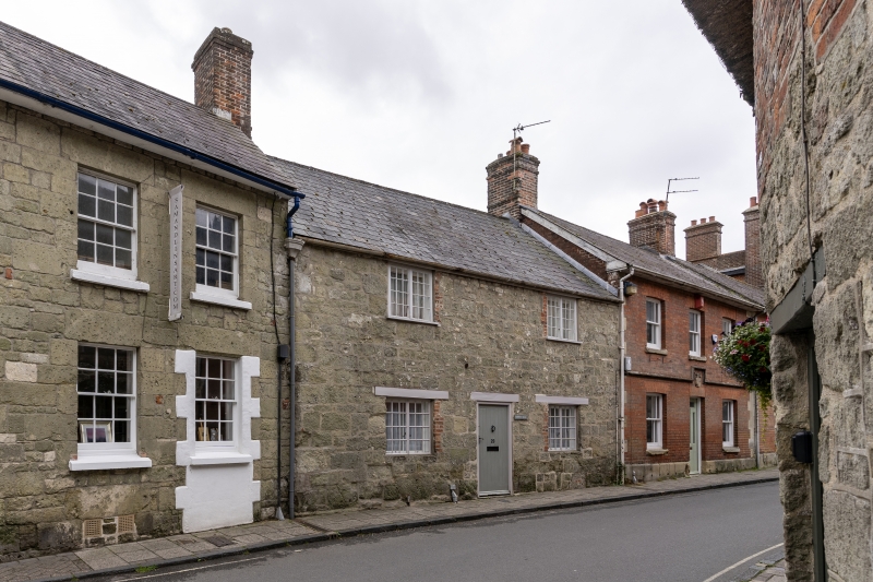
1615 BELL STREET
(South Side)
No 29
ST 8623 1/120
II GV
2.
C18. 2 storeys. 2 windows. Painted stone rubble front. Gabled roof.
2-light casement windows with small panes and wooden lintels; wooden boarded
door in frame also with lintel.
Nos 29 to 33 (odd) form a group.
Listing NGR: ST8634023070
External links are from the relevant listing authority and, where applicable, Wikidata. Wikidata IDs may be related buildings as well as this specific building. If you want to add or update a link, you will need to do so by editing the Wikidata entry.


Other nearby listed buildings
