Approximate Location Map
Large Map »
Latitude: 50.9927 / 50°59'33"N
Longitude: -2.2992 / 2°17'57"W
OS Eastings: 379098
OS Northings: 121521
OS Grid: ST790215
Mapcode National: GBR 0W7.MK1
Mapcode Global: FRA 662H.83S
Plus Code: 9C2VXPV2+38
Entry Name: Stour Provost Mill
Listing Date: 14 June 1984
Grade: II
Source: Historic England
Source ID: 1110382
English Heritage Legacy ID: 102774
ID on this website: 101110382
Location: Stour Provost, Dorset, SP8
County: Dorset
Civil Parish: Stour Provost
Traditional County: Dorset
Lieutenancy Area (Ceremonial County): Dorset
Church of England Parish: Stour Provost
Church of England Diocese: Salisbury
Tagged with: Building
ST 72 SE STOUR PROVOST MILL LANE
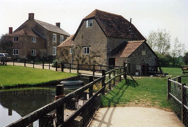
2/144 Stour Provost Mill
GV II
Mill, now cottage, probably early C19. Coursed rubble with
half-hipped, tiled roof. 1½ storeys. Casements with leaded-lights
under wooden lintels. Plain door under open porch. Cast-iron,
breast shot mill-wheel inscribed 'Bourton 1889'.
RCHM, Dorset, vol IV, p 82, no 7.
Listing NGR: ST7909821521
External links are from the relevant listing authority and, where applicable, Wikidata. Wikidata IDs may be related buildings as well as this specific building. If you want to add or update a link, you will need to do so by editing the Wikidata entry.


Other nearby listed buildings
