Approximate Location Map
Large Map »
Latitude: 50.9593 / 50°57'33"N
Longitude: -2.1256 / 2°7'32"W
OS Eastings: 391272
OS Northings: 117773
OS Grid: ST912177
Mapcode National: GBR 1Y5.WYP
Mapcode Global: FRA 66FK.XC0
Plus Code: 9C2VXV5F+PP
Entry Name: Outbuilding Approximately 30M North-West of the Old Rectory
Listing Date: 16 August 1960
Last Amended: 3 January 1985
Grade: II
Source: Historic England
Source ID: 1110339
English Heritage Legacy ID: 102863
ID on this website: 101110339
Location: Ashmore, Dorset, SP5
County: Dorset
Civil Parish: Ashmore
Traditional County: Dorset
Lieutenancy Area (Ceremonial County): Dorset
Church of England Parish: Ashmore St Nicholas
Church of England Diocese: Salisbury
Tagged with: Appendage
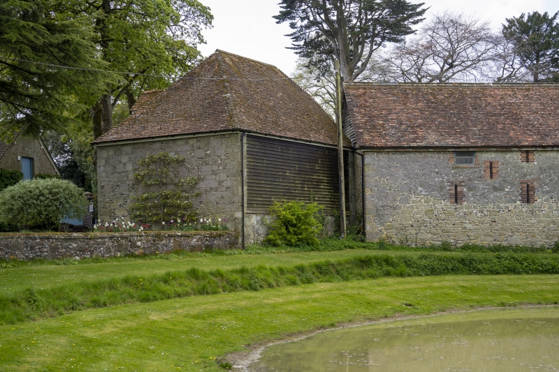
ST 91 NW ASHMORE VILLAGE POND
11/21 Outbuilding
approximately 30m
16.8.60. north-west of the
Old Rectory
(formerly listed
as Outbuildings in
Rectory grounds)
GV II
Outbuilding, c.C18. Greensand and flint and weatherboarding. Hipped,
tiled roof. Included for group value.
Listing NGR: ST9127217773
External links are from the relevant listing authority and, where applicable, Wikidata. Wikidata IDs may be related buildings as well as this specific building. If you want to add or update a link, you will need to do so by editing the Wikidata entry.


Other nearby listed buildings
