Approximate Location Map
Large Map »
Latitude: 51.0376 / 51°2'15"N
Longitude: -2.2755 / 2°16'31"W
OS Eastings: 380776
OS Northings: 126511
OS Grid: ST807265
Mapcode National: GBR 0VP.TRS
Mapcode Global: FRA 663C.R9R
Plus Code: 9C3V2PQF+3Q
Entry Name: Town Bridge
Listing Date: 16 August 1960
Grade: II
Source: Historic England
Source ID: 1110335
English Heritage Legacy ID: 102957
ID on this website: 101110335
Location: Gillingham, Dorset, SP8
County: Dorset
Civil Parish: Gillingham
Built-Up Area: Gillingham
Traditional County: Dorset
Lieutenancy Area (Ceremonial County): Dorset
Church of England Parish: Gillingham St Mary the Virgin
Church of England Diocese: Salisbury
Tagged with: Bridge
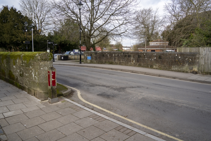
ST 8026 GILLINGHAM HIGH STREET
12/116 Town Bridge
16.8.60.
GV II
Road bridge over Shreen Water, dated 'County Bridge 1800'. Ashlar, of
2 semi-circular arches. Keystones. Cut-water to north side. Plain
parapet. Subject of a painting by J Constable.
(RCHM, Dorset, vol IV, p 30, no 3).
Listing NGR: ST8077626511
External links are from the relevant listing authority and, where applicable, Wikidata. Wikidata IDs may be related buildings as well as this specific building. If you want to add or update a link, you will need to do so by editing the Wikidata entry.


Other nearby listed buildings
