Approximate Location Map
Large Map »
Latitude: 51.0376 / 51°2'15"N
Longitude: -2.2775 / 2°16'38"W
OS Eastings: 380642
OS Northings: 126508
OS Grid: ST806265
Mapcode National: GBR 0VP.T70
Mapcode Global: FRA 663C.QKF
Plus Code: 9C3V2PQF+22
Entry Name: Lock-Up
Listing Date: 3 January 1985
Grade: II
Source: Historic England
Source ID: 1324574
English Heritage Legacy ID: 102990
ID on this website: 101324574
Location: Gillingham, Dorset, SP8
County: Dorset
Civil Parish: Gillingham
Built-Up Area: Gillingham
Traditional County: Dorset
Lieutenancy Area (Ceremonial County): Dorset
Church of England Parish: Gillingham St Mary the Virgin
Church of England Diocese: Salisbury
Tagged with: Village lock-up
ST 8026
12/151
GILLINGHAM
SOUTH STREET
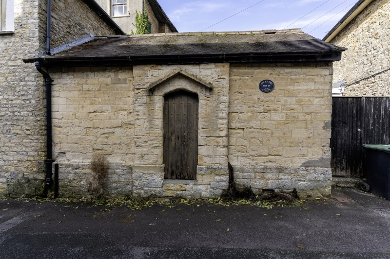
Lock-up
II
Lock-up, early C19. Coursed, squared rubble with gable-ended, tiled
roof. Single storey. No windows. Central bay projects slightly.
Unmoulded, central doorway with 4-centred head and simple pitched label.
Studded plank door.
(RCHM, Dorset, vol IV, p 30, no 9).
Listing NGR: ST8064226508
External links are from the relevant listing authority and, where applicable, Wikidata. Wikidata IDs may be related buildings as well as this specific building. If you want to add or update a link, you will need to do so by editing the Wikidata entry.


Other nearby listed buildings
