Approximate Location Map
Large Map »
Latitude: 50.7157 / 50°42'56"N
Longitude: -2.4352 / 2°26'6"W
OS Eastings: 369369
OS Northings: 90764
OS Grid: SY693907
Mapcode National: GBR PY.RGGM
Mapcode Global: FRA 57S6.328
Plus Code: 9C2VPH87+7W
Entry Name: 35, High East Street
Listing Date: 8 May 1975
Grade: II
Source: Historic England
Source ID: 1110588
English Heritage Legacy ID: 104330
ID on this website: 101110588
Location: Dorchester, Dorset, DT1
County: Dorset
Civil Parish: Dorchester
Built-Up Area: Dorchester
Traditional County: Dorset
Lieutenancy Area (Ceremonial County): Dorset
Church of England Parish: Dorchester and West Stafford
Church of England Diocese: Salisbury
Tagged with: Building
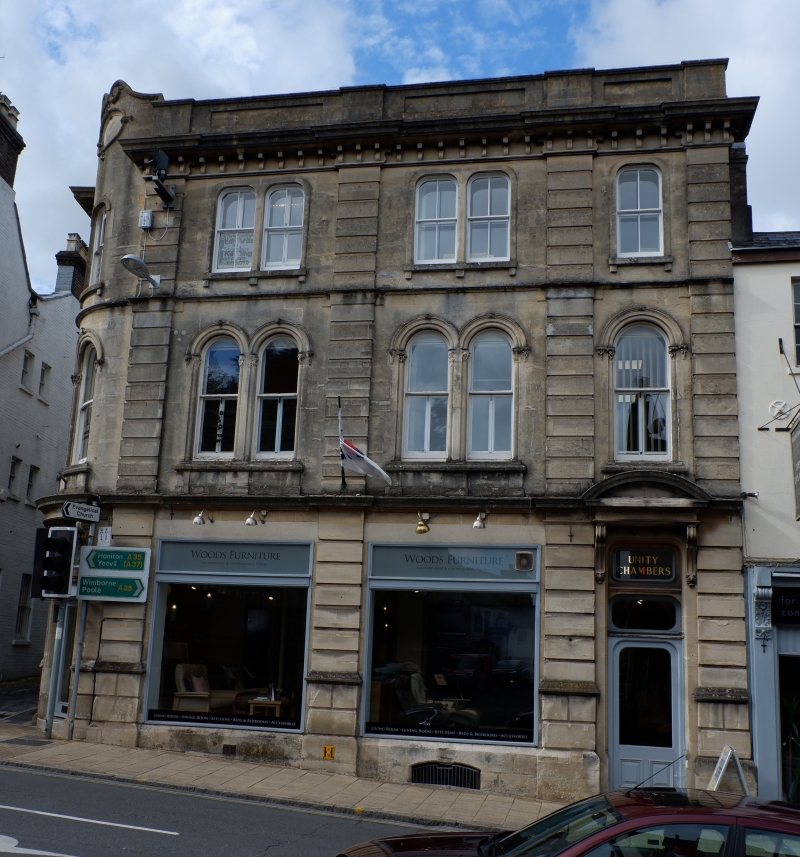
HIGH EAST STREET
1.
5191
(North Side)
No 35
SY 699O 7/39
II GV
2.
3 storey, 4 window stucco front. Early C19. Moulded eaves cornice. Large
Victorian shopfront.
Nos 35 to 43 (consec) and Nos 39A and 39B, and Arch between Nos 40 to 41 and
British Legion Headquarters form a group.
Listing NGR: SY6936990764
External links are from the relevant listing authority and, where applicable, Wikidata. Wikidata IDs may be related buildings as well as this specific building. If you want to add or update a link, you will need to do so by editing the Wikidata entry.


Other nearby listed buildings
