Approximate Location Map
Large Map »
Latitude: 50.7336 / 50°44'1"N
Longitude: -2.7549 / 2°45'17"W
OS Eastings: 346822
OS Northings: 92939
OS Grid: SY468929
Mapcode National: GBR PP.0CXX
Mapcode Global: FRA 5734.QJL
Plus Code: 9C2VP6MW+C2
Entry Name: 7, Barrack Street
Listing Date: 19 September 1975
Grade: II
Source: Historic England
Source ID: 1287962
English Heritage Legacy ID: 104465
ID on this website: 101287962
Location: Bridport, Dorset, DT6
County: Dorset
Civil Parish: Bridport
Built-Up Area: Bridport
Traditional County: Dorset
Lieutenancy Area (Ceremonial County): Dorset
Church of England Parish: Bridport St Mary
Church of England Diocese: Salisbury
Tagged with: Building
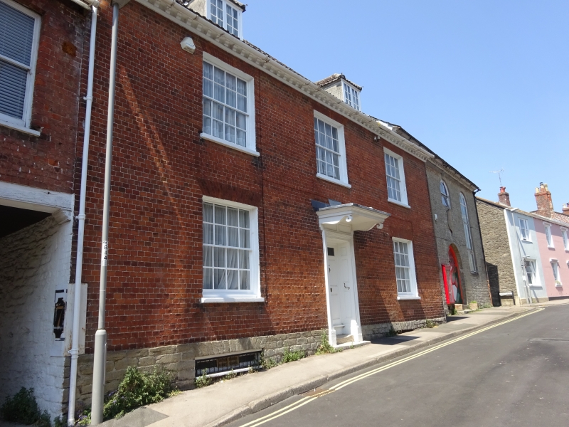
1.
5191 BARRACK STREET
(West Side)
No 7
SY 4692 1/37
II GV
2.
Late C18. Red brick. 2 storeys and attics. Modillion eaves cornice. Stone
plinth. 3 ranges of sashes with glazing bars, 2 hipped attic dormers. Door
with fielded panelling in reveals, moulded architrave and hood on shaped brackets.
Nos 3 to 11 (odd) form a group.
Listing NGR: SY4682292939
External links are from the relevant listing authority and, where applicable, Wikidata. Wikidata IDs may be related buildings as well as this specific building. If you want to add or update a link, you will need to do so by editing the Wikidata entry.


Other nearby listed buildings
