Approximate Location Map
Large Map »
Latitude: 50.7323 / 50°43'56"N
Longitude: -2.7567 / 2°45'23"W
OS Eastings: 346695
OS Northings: 92791
OS Grid: SY466927
Mapcode National: GBR PP.0CH5
Mapcode Global: FRA 5734.PW1
Plus Code: 9C2VP6JV+W8
Entry Name: 3 and 4, Chancery Lane
Listing Date: 19 September 1975
Grade: II
Source: Historic England
Source ID: 1119027
English Heritage Legacy ID: 104480
ID on this website: 101119027
Location: New Zealand, Dorset, DT6
County: Dorset
Civil Parish: Bridport
Built-Up Area: Bridport
Traditional County: Dorset
Lieutenancy Area (Ceremonial County): Dorset
Church of England Parish: Bridport St Mary
Church of England Diocese: Salisbury
Tagged with: Building
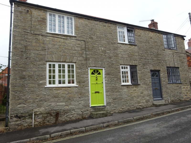
1.
5191
SY 4692
1/225
CHANCERY LANE
(West Side)
Nos 3 and 4
II
2.
C19. Hammer dressed stone. Pitched slate roof. Red brick stacks. 2 storeys.
3 ranges of casements with glazing bars. 2 modern doors.
Listing NGR: SY4669592791
External links are from the relevant listing authority and, where applicable, Wikidata. Wikidata IDs may be related buildings as well as this specific building. If you want to add or update a link, you will need to do so by editing the Wikidata entry.


Other nearby listed buildings
