Approximate Location Map
Large Map »
Latitude: 50.7324 / 50°43'56"N
Longitude: -2.7564 / 2°45'23"W
OS Eastings: 346710
OS Northings: 92802
OS Grid: SY467928
Mapcode National: GBR PP.0CJ6
Mapcode Global: FRA 5734.PY6
Plus Code: 9C2VP6JV+XC
Entry Name: 18, Chancery Lane
Listing Date: 19 September 1975
Grade: II
Source: Historic England
Source ID: 1118982
English Heritage Legacy ID: 104482
ID on this website: 101118982
Location: New Zealand, Dorset, DT6
County: Dorset
Civil Parish: Bridport
Built-Up Area: Bridport
Traditional County: Dorset
Lieutenancy Area (Ceremonial County): Dorset
Church of England Parish: Bridport St Mary
Church of England Diocese: Salisbury
Tagged with: Building
1.
5191
SY 4692
1/228
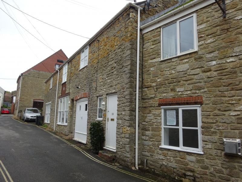
CHANCERY LANE
(East Side)
No 18
II
2.
Early C19, possibly older. Rubble. Pitched slate roof. 2 storeys. 3 pairs
of planked double doors and 1 fixed window on ground floor. 2 plate glass
windows on 1st floor and 1 loading door with remains of winch hoist.
Listing NGR: SY4671092802
External links are from the relevant listing authority and, where applicable, Wikidata. Wikidata IDs may be related buildings as well as this specific building. If you want to add or update a link, you will need to do so by editing the Wikidata entry.


Other nearby listed buildings
