Approximate Location Map
Large Map »
Latitude: 50.7334 / 50°44'0"N
Longitude: -2.7551 / 2°45'18"W
OS Eastings: 346808
OS Northings: 92913
OS Grid: SY468929
Mapcode National: GBR PP.0CWX
Mapcode Global: FRA 5734.QGH
Plus Code: 9C2VP6MV+9X
Entry Name: 57, East Street
Listing Date: 19 September 1975
Grade: II
Source: Historic England
Source ID: 1119000
English Heritage Legacy ID: 104517
ID on this website: 101119000
Location: New Zealand, Dorset, DT6
County: Dorset
Civil Parish: Bridport
Built-Up Area: Bridport
Traditional County: Dorset
Lieutenancy Area (Ceremonial County): Dorset
Church of England Parish: Bridport St Mary
Church of England Diocese: Salisbury
Tagged with: Building
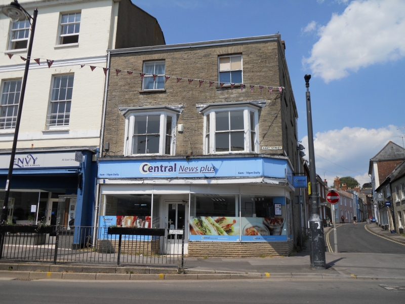
1.
5191 EAST STREET
(North Side)
No 57
SY 4692 1/25
II GV
2.
Mid C19. Hammer dressed stone. Hipped modern roof. 3 storeys. 2 sashes
on 2nd floor. 2 canted wooden oriels with sashes on lst floor. Modern shops,
3 ranges of sashes to Barrack Street.
Nos 37 to 47 (odd), the Unitarian Chapel, the Public Library, and Nos 53 to 57 (odd)
form a group.
Listing NGR: SY4680892913
External links are from the relevant listing authority and, where applicable, Wikidata. Wikidata IDs may be related buildings as well as this specific building. If you want to add or update a link, you will need to do so by editing the Wikidata entry.


Other nearby listed buildings
