Approximate Location Map
Large Map »
Latitude: 50.7333 / 50°43'59"N
Longitude: -2.7542 / 2°45'15"W
OS Eastings: 346868
OS Northings: 92902
OS Grid: SY468929
Mapcode National: GBR PP.L63T
Mapcode Global: FRA 5734.QTJ
Plus Code: 9C2VP6MW+88
Entry Name: 67 and 69, East Street
Listing Date: 19 September 1975
Grade: II
Source: Historic England
Source ID: 1287852
English Heritage Legacy ID: 104521
ID on this website: 101287852
Location: New Zealand, Dorset, DT6
County: Dorset
Civil Parish: Bridport
Built-Up Area: Bridport
Traditional County: Dorset
Lieutenancy Area (Ceremonial County): Dorset
Church of England Parish: Bridport St Mary
Church of England Diocese: Salisbury
Tagged with: Building
1.
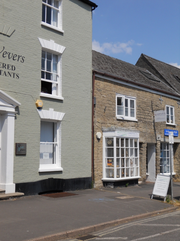
5191 EAST STREET
(North Side)
Nos 67 and 69
SY 4692 1/71
II GV
2.
C18, possibly earlier. Hammer dressed stone. 2 storeys. Altered doors and
windows. Shop windows inserted.
Nos 61 to 115 (odd) and wall from east end of No 115 form a group.
Listing NGR: SY4686492904
External links are from the relevant listing authority and, where applicable, Wikidata. Wikidata IDs may be related buildings as well as this specific building. If you want to add or update a link, you will need to do so by editing the Wikidata entry.


Other nearby listed buildings
