Approximate Location Map
Large Map »
Latitude: 50.7333 / 50°43'59"N
Longitude: -2.7573 / 2°45'26"W
OS Eastings: 346653
OS Northings: 92907
OS Grid: SY466929
Mapcode National: GBR PP.0C98
Mapcode Global: FRA 5734.PLX
Plus Code: 9C2VP6MV+83
Entry Name: 14 and 16, East Street
Listing Date: 19 September 1975
Grade: II
Source: Historic England
Source ID: 1118961
English Heritage Legacy ID: 104533
ID on this website: 101118961
Location: Bridport, Dorset, DT6
County: Dorset
Civil Parish: Bridport
Built-Up Area: Bridport
Traditional County: Dorset
Lieutenancy Area (Ceremonial County): Dorset
Church of England Parish: Bridport St Mary
Church of England Diocese: Salisbury
Tagged with: Building
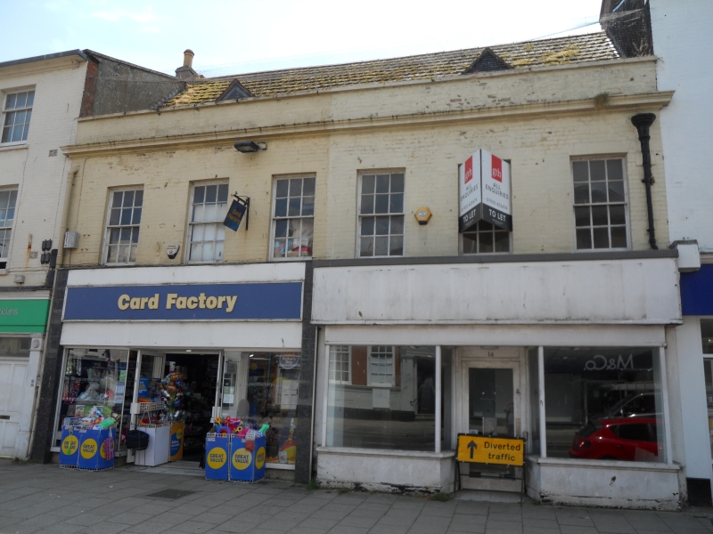
1.
5191 EAST STREET
(South Side)
Nos 14 & 16
SY 4692 1/257
II GV
2.
Mid C18. Colour washed brick. Modern pitched roof. 2 storeys and attics.
Moulded eaves cornice and parapet. 6 ranges of sashes with glazing bars.
2 gabled attic dormers. Modern shopfronts. 1 contemporary rainwater head.
Nos 8 to 36 (even) form a group with the United Reformed and Methodist Church.
Listing NGR: SY4665092906
External links are from the relevant listing authority and, where applicable, Wikidata. Wikidata IDs may be related buildings as well as this specific building. If you want to add or update a link, you will need to do so by editing the Wikidata entry.


Other nearby listed buildings
