Approximate Location Map
Large Map »
Latitude: 50.733 / 50°43'58"N
Longitude: -2.7536 / 2°45'12"W
OS Eastings: 346911
OS Northings: 92869
OS Grid: SY469928
Mapcode National: GBR PP.L69D
Mapcode Global: FRA 5734.R1J
Plus Code: 9C2VP6MW+6H
Entry Name: 76 and 78, East Street
Listing Date: 19 September 1975
Grade: II
Source: Historic England
Source ID: 1324076
English Heritage Legacy ID: 104549
ID on this website: 101324076
Location: New Zealand, Dorset, DT6
County: Dorset
Civil Parish: Bridport
Built-Up Area: Bridport
Traditional County: Dorset
Lieutenancy Area (Ceremonial County): Dorset
Church of England Parish: Bridport St Mary
Church of England Diocese: Salisbury
Tagged with: Building
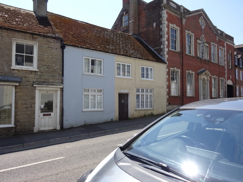
1.
5191 EAST STREET
(South Side)
Nos 76 and 78
SY 4692 1/267
II GV
2.
C18 or earlier. Rendered. Pitched slate roof. 2 storeys. 3 ranges of casements.
C19 shopfront on ground floor of No 76. Covered passageway to yard behind.
No 78 has 2 storey extension with hipped tile roof and stone slates at eaves.
1 storey extension behind this.
Nos 74 to 92 (even) form a group.
Listing NGR: SY4690792866
External links are from the relevant listing authority and, where applicable, Wikidata. Wikidata IDs may be related buildings as well as this specific building. If you want to add or update a link, you will need to do so by editing the Wikidata entry.


Other nearby listed buildings
