Approximate Location Map
Large Map »
Latitude: 50.8831 / 50°52'59"N
Longitude: -2.5245 / 2°31'28"W
OS Eastings: 363196
OS Northings: 109417
OS Grid: ST631094
Mapcode National: GBR MT.SQ74
Mapcode Global: FRA 56LR.Y0L
Plus Code: 9C2VVFMG+65
Entry Name: Milestone
Listing Date: 8 October 1986
Grade: II
Source: Historic England
Source ID: 1119197
English Heritage Legacy ID: 106051
ID on this website: 101119197
Location: Higher Totnell, Dorset, DT9
County: Dorset
Civil Parish: Leigh
Traditional County: Dorset
Lieutenancy Area (Ceremonial County): Dorset
Church of England Parish: Leigh St Andrew
Church of England Diocese: Salisbury
Tagged with: Milestone
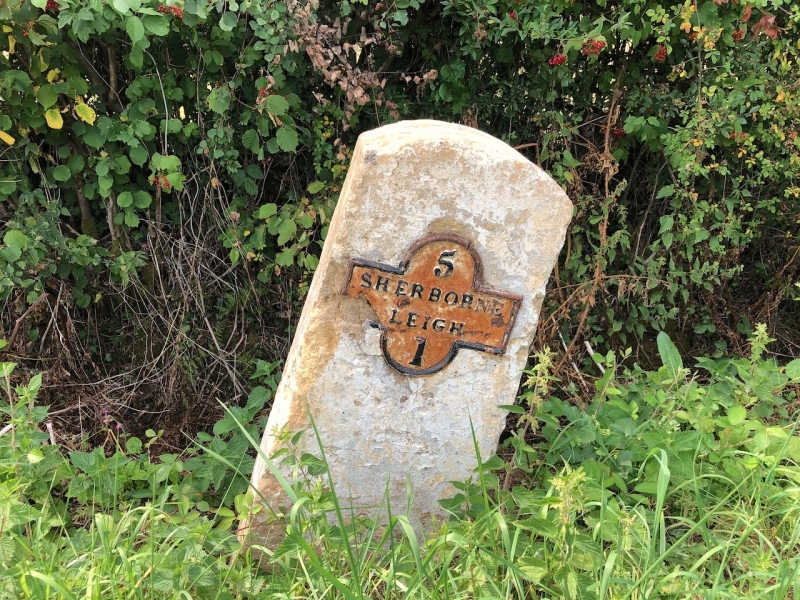
LEIGH
ST 60 NW, at ST 632094 BAILEY RIDGE
5/33 Milestone
- II
Milestone, segmental topped, carrying iron plate with inscription "5 Sherborne
1 Leigh". Erected by the Shaftesbury and Sherborne Trust, 1752-1877.
Listing NGR: ST6319609417
External links are from the relevant listing authority and, where applicable, Wikidata. Wikidata IDs may be related buildings as well as this specific building. If you want to add or update a link, you will need to do so by editing the Wikidata entry.


Other nearby listed buildings
