Approximate Location Map
Large Map »
Latitude: 50.8009 / 50°48'3"N
Longitude: -1.9871 / 1°59'13"W
OS Eastings: 401008
OS Northings: 100150
OS Grid: SU010001
Mapcode National: GBR 31M.NFV
Mapcode Global: FRA 66QZ.9PL
Plus Code: 9C2WR227+95
Entry Name: Boundary Wall to No 6
Listing Date: 2 February 1983
Grade: II
Source: Historic England
Source ID: 1323780
English Heritage Legacy ID: 107049
ID on this website: 101323780
Location: Wimborne Minster, Dorset, BH21
County: Dorset
Civil Parish: Wimborne Minster
Built-Up Area: Wimborne Minster
Traditional County: Dorset
Lieutenancy Area (Ceremonial County): Dorset
Church of England Parish: Wimborne Minster St Cuthberga
Church of England Diocese: Salisbury
Tagged with: Wall
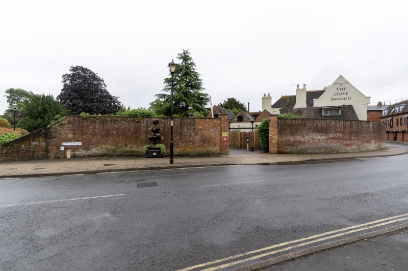
EAST BOROUGH
1..
5193
(east side)
Boundary wall to
No 6
SU 0100 SW 2/26
II GV
2.
Brick boundary wall extending northwards from the house, - probably late C18-
early C19.
Listing NGR: SU0100800150
External links are from the relevant listing authority and, where applicable, Wikidata. Wikidata IDs may be related buildings as well as this specific building. If you want to add or update a link, you will need to do so by editing the Wikidata entry.


Other nearby listed buildings
