Approximate Location Map
Large Map »
Latitude: 50.7981 / 50°47'53"N
Longitude: -1.984 / 1°59'2"W
OS Eastings: 401220
OS Northings: 99840
OS Grid: SZ012998
Mapcode National: GBR 31M.WRT
Mapcode Global: FRA 66QZ.JW6
Plus Code: 9C2WQ2X8+69
Entry Name: 5, Leigh Road
Listing Date: 2 February 1983
Grade: II
Source: Historic England
Source ID: 1153474
English Heritage Legacy ID: 107104
ID on this website: 101153474
Location: East Brook, Dorset, BH21
County: Dorset
Civil Parish: Wimborne Minster
Built-Up Area: Wimborne Minster
Traditional County: Dorset
Lieutenancy Area (Ceremonial County): Dorset
Church of England Parish: Wimborne Minster St Cuthberga
Church of England Diocese: Salisbury
Tagged with: Building
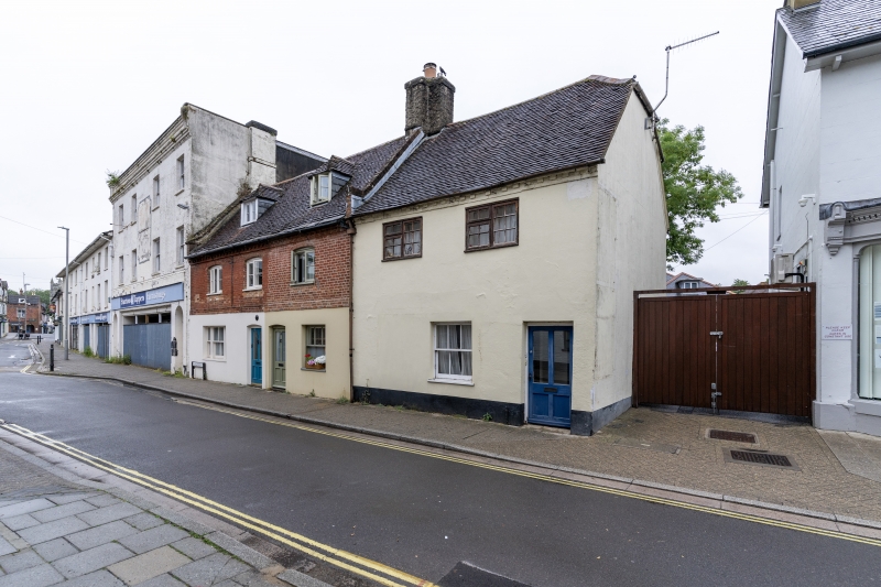
LEIGH ROAD
1.
5193
(north side)
No 5
SZ 0199 NW 2/80
II GV
2.
Continuation of Nos 1 and 3. Appears C18. Rendered walls, with brick dentil
cornice at eaves. Tiled roof. Rendered stack. Two storeys. Ground floor has
modern glazed door and casement window. First floor has 2 windows, now with
modern pivoted sashes. Included for group value in spite of alterations.
Listing NGR: SZ0122099840
External links are from the relevant listing authority and, where applicable, Wikidata. Wikidata IDs may be related buildings as well as this specific building. If you want to add or update a link, you will need to do so by editing the Wikidata entry.


Other nearby listed buildings
