Approximate Location Map
Large Map »
Latitude: 50.8007 / 50°48'2"N
Longitude: -1.9883 / 1°59'17"W
OS Eastings: 400923
OS Northings: 100122
OS Grid: SU009001
Mapcode National: GBR 31M.N55
Mapcode Global: FRA 66QZ.97G
Plus Code: 9C2WR226+7M
Entry Name: 6, West Borough
Listing Date: 14 June 1952
Last Amended: 2 February 1983
Grade: II
Source: Historic England
Source ID: 1119526
English Heritage Legacy ID: 107142
ID on this website: 101119526
Location: Wimborne Minster, Dorset, BH21
County: Dorset
Civil Parish: Wimborne Minster
Built-Up Area: Wimborne Minster
Traditional County: Dorset
Lieutenancy Area (Ceremonial County): Dorset
Church of England Parish: Wimborne Minster St Cuthberga
Church of England Diocese: Salisbury
Tagged with: Building
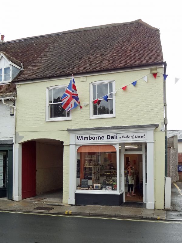
WEST BOROUGH
1.
5193 (east side)
No 6
(formerly listed
14.6.52 as No 74
SU 0000 SE 2/118
GV
II
2.
C18. Brick walls. Tiled roof. Two storeys. Ground floor has modern shop front
and large archway adjoining. First floor has 2 double hung sash windows with
vertical glazing bars only.
Listing NGR: SU0092300122
External links are from the relevant listing authority and, where applicable, Wikidata. Wikidata IDs may be related buildings as well as this specific building. If you want to add or update a link, you will need to do so by editing the Wikidata entry.


Other nearby listed buildings
