Approximate Location Map
Large Map »
Latitude: 50.8107 / 50°48'38"N
Longitude: -2.032 / 2°1'55"W
OS Eastings: 397842
OS Northings: 101234
OS Grid: ST978012
Mapcode National: GBR 31K.32Q
Mapcode Global: FRA 66MY.J6G
Plus Code: 9C2VRX69+76
Entry Name: Garden Wall 20 M South of Kingston Lacy House
Listing Date: 2 November 1982
Grade: II
Source: Historic England
Source ID: 1152817
English Heritage Legacy ID: 107208
ID on this website: 101152817
Location: Dorset, BH21
County: Dorset
Civil Parish: Pamphill
Traditional County: Dorset
Lieutenancy Area (Ceremonial County): Dorset
Church of England Parish: Kingston Lacy St Stephen
Church of England Diocese: Salisbury
Tagged with: Wall
1.
5193 PAMPHILL
Garden wall 20 m south of
Kingston Lacey House
ST 90 SE 3/10 2.11.82
II GV
2.
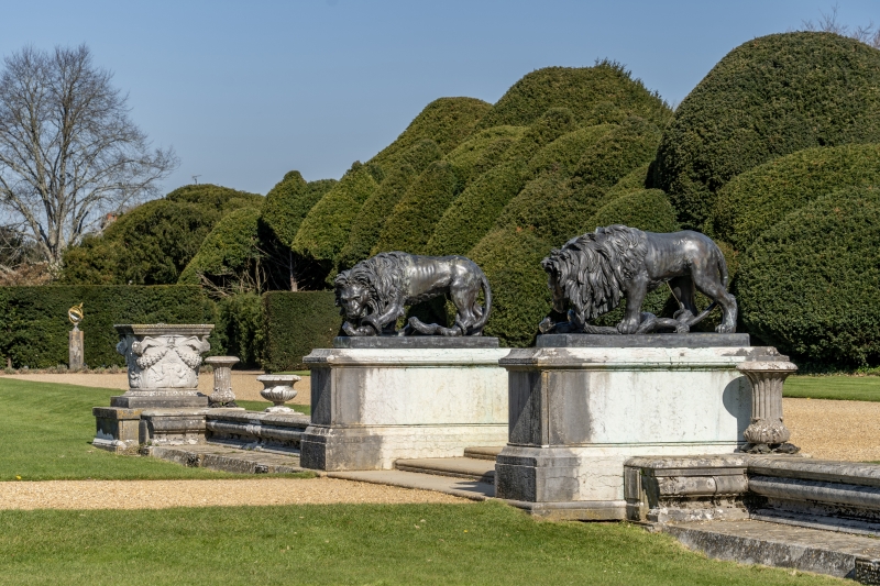
Circa 1835. Low stone terrace wall with moulded capping. Steps in centre,
flanked by bronze lions on stone pedestals. Carved stone runs at intervals
along wall.
Listing NGR: ST9784201234
External links are from the relevant listing authority and, where applicable, Wikidata. Wikidata IDs may be related buildings as well as this specific building. If you want to add or update a link, you will need to do so by editing the Wikidata entry.


Other nearby listed buildings
