Approximate Location Map
Large Map »
Latitude: 50.8115 / 50°48'41"N
Longitude: -2.0243 / 2°1'27"W
OS Eastings: 398386
OS Northings: 101327
OS Grid: ST983013
Mapcode National: GBR 31K.51B
Mapcode Global: FRA 66NY.F76
Plus Code: 9C2VRX6G+H7
Entry Name: Granary North of Keeper's Lodge
Listing Date: 2 November 1982
Grade: II
Source: Historic England
Source ID: 1119482
English Heritage Legacy ID: 107237
ID on this website: 101119482
Location: Dorset, BH21
County: Dorset
Civil Parish: Pamphill
Traditional County: Dorset
Lieutenancy Area (Ceremonial County): Dorset
Church of England Parish: Kingston Lacy St Stephen
Church of England Diocese: Salisbury
Tagged with: Granary
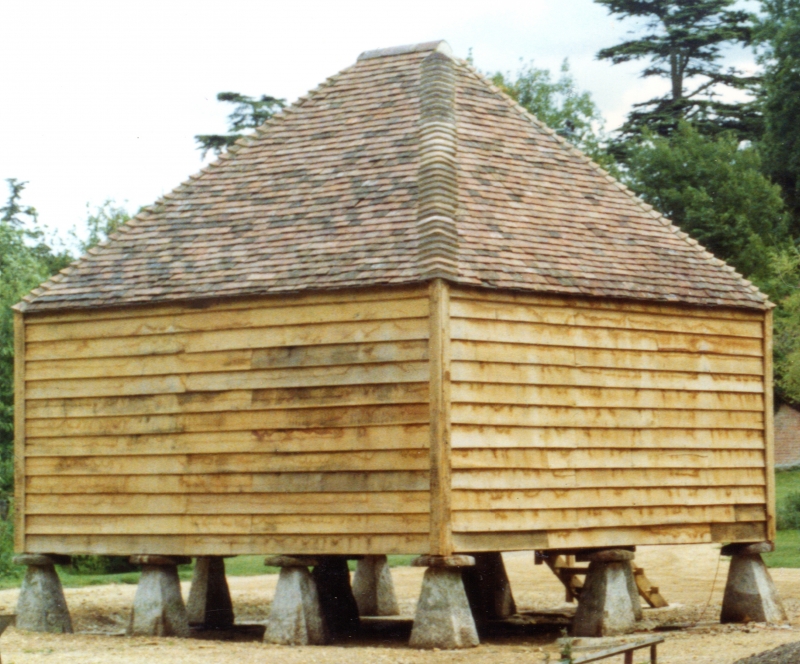
1.
5193 PAMPHILL BLANDFORD ROAD
(South-west Side)
Granary north of
Keeper's Lodge
ST 90 SE 3/89 2.11.82
II GV
2.
Probably late C18. Granary, on saddle-stones has timber-framed walls,
weather-boarded, and tiled hipped roof.
Included for group value.
Listing NGR: ST9838601327
External links are from the relevant listing authority and, where applicable, Wikidata. Wikidata IDs may be related buildings as well as this specific building. If you want to add or update a link, you will need to do so by editing the Wikidata entry.


Other nearby listed buildings
