Approximate Location Map
Large Map »
Latitude: 50.6466 / 50°38'47"N
Longitude: -2.2237 / 2°13'25"W
OS Eastings: 384280
OS Northings: 83019
OS Grid: SY842830
Mapcode National: GBR 21X.8MN
Mapcode Global: FRA 677C.FHL
Plus Code: 9C2VJQWG+MG
Entry Name: Clare Towers
Listing Date: 2 October 1984
Grade: II
Source: Historic England
Source ID: 1323332
English Heritage Legacy ID: 108552
ID on this website: 101323332
Location: Lulworth Park, Dorset, BH20
County: Dorset
Civil Parish: Coombe Keynes
Traditional County: Dorset
Lieutenancy Area (Ceremonial County): Dorset
Church of England Parish: Wool, East Burton and Combe Keynes
Church of England Diocese: Salisbury
Tagged with: Architectural structure
SY 88SW
7/94 COOMBE KEYNES
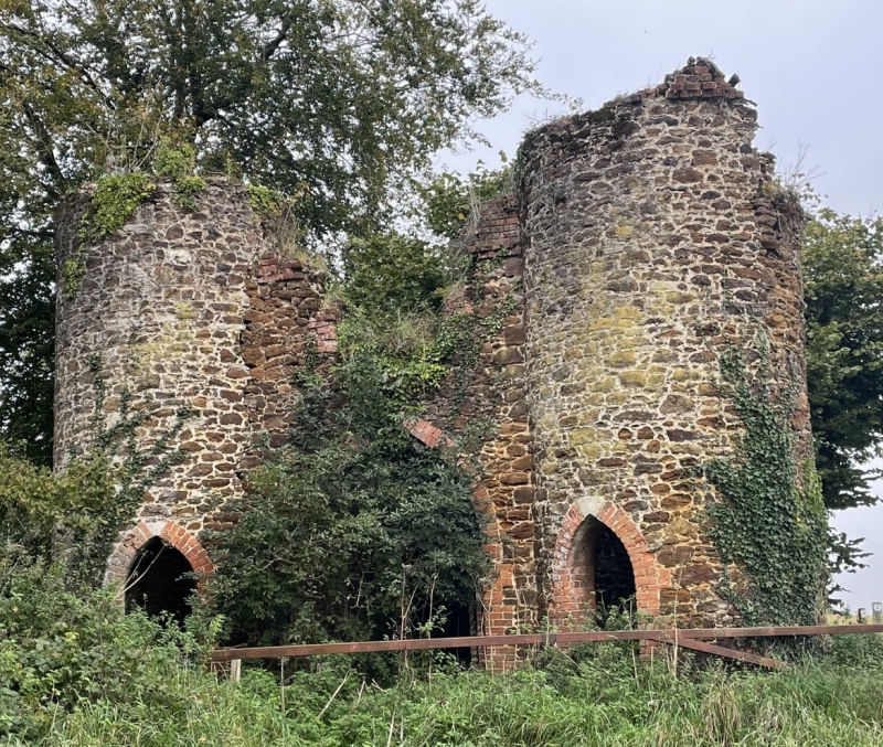
Clare Towers
II
Former entrance gateway to Lulworth Park. Late C18. Rubblestone with brick
dressings. Pair of circular towers linked by a wall with pointed archway. Pointed
arched openings in base of each tower.
Ruinous and overgrown with ivy.
Listing NGR: SY8428083019
External links are from the relevant listing authority and, where applicable, Wikidata. Wikidata IDs may be related buildings as well as this specific building. If you want to add or update a link, you will need to do so by editing the Wikidata entry.


Other nearby listed buildings
