Approximate Location Map
Large Map »
Latitude: 50.7026 / 50°42'9"N
Longitude: -2.2768 / 2°16'36"W
OS Eastings: 380545
OS Northings: 89256
OS Grid: SY805892
Mapcode National: GBR 0ZR.TD3
Mapcode Global: FRA 6737.4SC
Plus Code: 9C2VPP3F+27
Entry Name: Remains of Medieval Font in Churchyard of Parish Church
Listing Date: 2 October 1984
Grade: II
Source: Historic England
Source ID: 1120484
English Heritage Legacy ID: 108645
ID on this website: 101120484
Location: St Nicholas's Church, Dorset, DT2
County: Dorset
Civil Parish: Moreton
Traditional County: Dorset
Lieutenancy Area (Ceremonial County): Dorset
Church of England Parish: Moreton St Nicholas
Church of England Diocese: Salisbury
Tagged with: Building
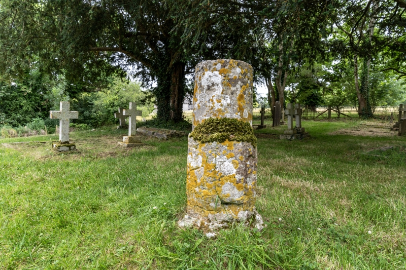
4/185 MORETON
Remains of medieval
font in churchyard of
Parish Church
II
Base of a medieval font, later altered to form a sundial - near south door of the
church. RCHM Monument 1.
Listing NGR: SY8054589256
External links are from the relevant listing authority and, where applicable, Wikidata. Wikidata IDs may be related buildings as well as this specific building. If you want to add or update a link, you will need to do so by editing the Wikidata entry.


Other nearby listed buildings
