Approximate Location Map
Large Map »
Latitude: 50.703 / 50°42'10"N
Longitude: -2.2755 / 2°16'31"W
OS Eastings: 380638
OS Northings: 89295
OS Grid: SY806892
Mapcode National: GBR 0ZR.TRL
Mapcode Global: FRA 6737.58V
Plus Code: 9C2VPP3F+5Q
Entry Name: Bridge in Moreton Park
Listing Date: 2 October 1984
Grade: II
Source: Historic England
Source ID: 1151950
English Heritage Legacy ID: 108648
ID on this website: 101151950
Location: Dorset, DT2
County: Dorset
Civil Parish: Moreton
Traditional County: Dorset
Lieutenancy Area (Ceremonial County): Dorset
Church of England Parish: Moreton St Nicholas
Church of England Diocese: Salisbury
Tagged with: Bridge
SY 88 NW
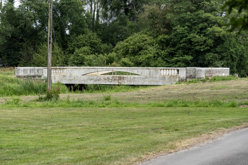
4/188 MORETON Bridge in Moreton
Park
II
Park Lodge. Built 1836, and constructed of iron. Iron joists carrying roadway
suspended from low segmental iron arches. Turned iron balusters each end of this
supporting iron coping. Circular stone piers at each end of parapet. Unusual
construction for its date.
RCHM Monument 5.
Listing NGR: SY8063889295
External links are from the relevant listing authority and, where applicable, Wikidata. Wikidata IDs may be related buildings as well as this specific building. If you want to add or update a link, you will need to do so by editing the Wikidata entry.


Other nearby listed buildings
