Approximate Location Map
Large Map »
Latitude: 50.7011 / 50°42'3"N
Longitude: -2.3124 / 2°18'44"W
OS Eastings: 378030
OS Northings: 89093
OS Grid: SY780890
Mapcode National: GBR 0ZP.XX4
Mapcode Global: FRA 6717.2YF
Plus Code: 9C2VPM2Q+C2
Entry Name: The Frampton Arms
Listing Date: 2 October 1984
Grade: II
Source: Historic England
Source ID: 1120455
English Heritage Legacy ID: 108680
Also known as: Frampton Arms
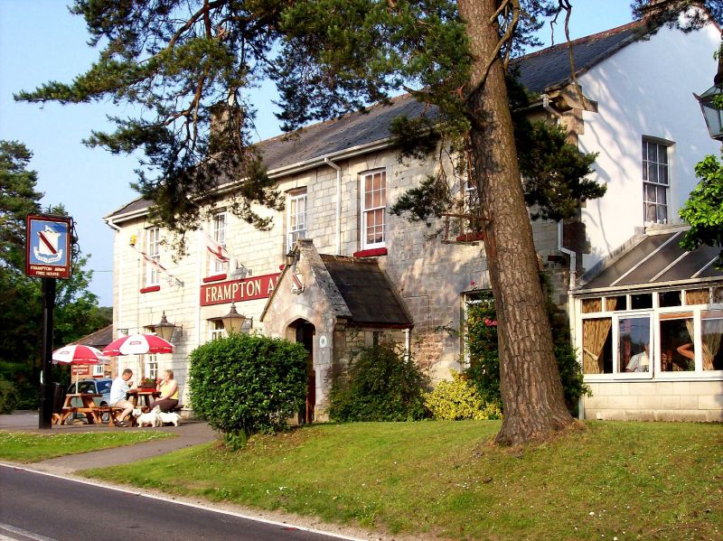
The Frampton Arms, Dorchester
ID on this website: 101120455
Location: Redbridge, Dorset, DT2
County: Dorset
Civil Parish: Moreton
Traditional County: Dorset
Lieutenancy Area (Ceremonial County): Dorset
Church of England Parish: Moreton St Nicholas
Church of England Diocese: Salisbury
Tagged with: Pub
SY 78NE
3/220 MORETON WADDOCK DRIVE
(East Side)
The Frampton Arms
II
Public House. Mid C19. Ashlar stone walls, gabled slate roof with stone copings,
rendered stacks. Two storeys. Porch with 4-centred arch and plain panelled door.
Ground floor has four double-hung sash windows with glazing bars. First floor has
four similar windows with keystones to low segmental arches.
Listing NGR: SY7803089093
External links are from the relevant listing authority and, where applicable, Wikidata. Wikidata IDs may be related buildings as well as this specific building. If you want to add or update a link, you will need to do so by editing the Wikidata entry.


Other nearby listed buildings
