Approximate Location Map
Large Map »
Latitude: 54.7784 / 54°46'42"N
Longitude: -1.5712 / 1°34'16"W
OS Eastings: 427676
OS Northings: 542696
OS Grid: NZ276426
Mapcode National: GBR KFG5.MV
Mapcode Global: WHC4Q.T5Z4
Plus Code: 9C6WQCHH+9G
Entry Name: 70, Claypath
Listing Date: 10 March 1988
Grade: II
Source: Historic England
Source ID: 1323237
English Heritage Legacy ID: 110120
ID on this website: 101323237
Location: The Sands, County Durham, DH1
County: County Durham
Electoral Ward/Division: Elvet and Gilesgate
Parish: City of Durham
Built-Up Area: Durham
Traditional County: Durham
Lieutenancy Area (Ceremonial County): County Durham
Church of England Parish: Durham St Nicholas
Church of England Diocese: Durham
Tagged with: Building
DURHAM AND FRAMWELLGATE
NZ 2742 NE
10/72
CLAYPATH
(South side)
No. 70
GV
II
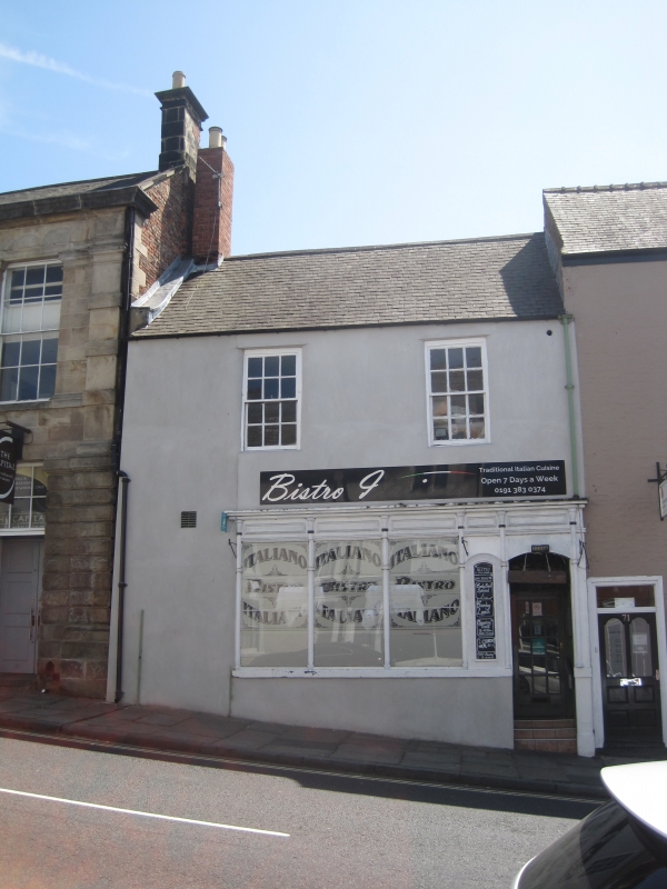
House and shop, now restaurant. Late C18. Incised stucco with felt-covered roof
and brick chimney. 2 storeys, 2 bays. Shop has early C19 slender pilasters
flanking door and window; sashes with glazing bars on first floor have plain
reveals. Small ventilator in roof.
Listing NGR: NZ2767642696
External links are from the relevant listing authority and, where applicable, Wikidata. Wikidata IDs may be related buildings as well as this specific building. If you want to add or update a link, you will need to do so by editing the Wikidata entry.


Other nearby listed buildings
